The next powerhouse storm storm arrives Tuesday night and runs into Wednesday. This one brings not just snow, but rain, flood potential and strong winds.
Precipitation will begin moving into western Maine by late Tuesday evening, increasing in coverage and intensity during the night. Most places will start as snow or a wintry mix, but gradually turn to rain as the low pressure system approaches.
As the storm pulls away Wednesday afternoon, it’ll take the rain/snow with it. Conditions will dry out from west to east Wednesday afternoon and evening.
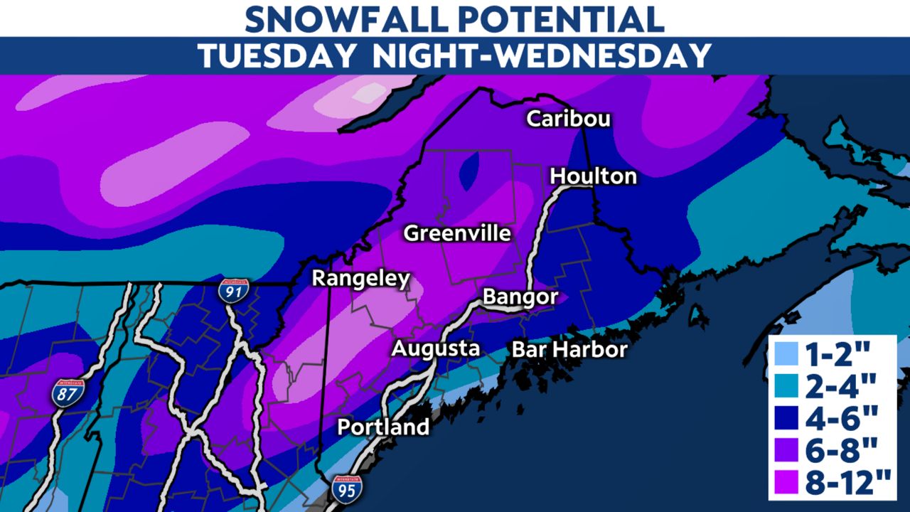
Unlike this past weekend’s storm, the heaviest snow should fall in a stripe along the mountains. There, 6 to 12 inches is expected with some higher amounts. The higher totals should be mostly confined to western Maine.
Amounts diminish into the foothills. The least will occur on the coast, perhaps up to a couple of inches (mainly Downeast).
Some of this snow will melt as temperatures warm and rain falls, especially outside the mountains.

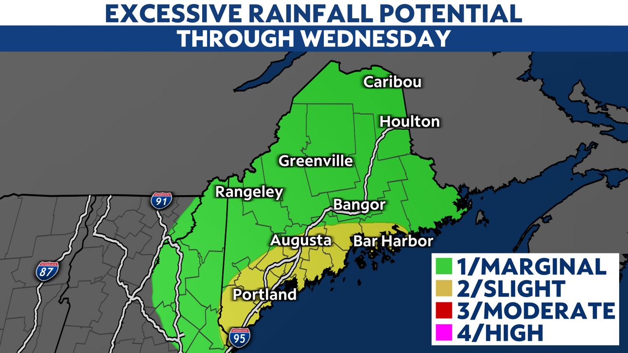
While the rainfall won’t be as high as in the storm a couple of weeks ago, we are still watching for significant amounts for this time of year. The highest rainfall should occur in southern and eastern Maine, with totals generally between 1 and 2 inches, with locally higher amounts possible.
Between the rain and snowmelt, areas of flooding are possible. Southwestern Maine, including Portland, is in a Flood Watch.
Most of the flooding potential should be limited to urban areas and small streams. However, the main rivers could climb into minor flood stage this week, as well.

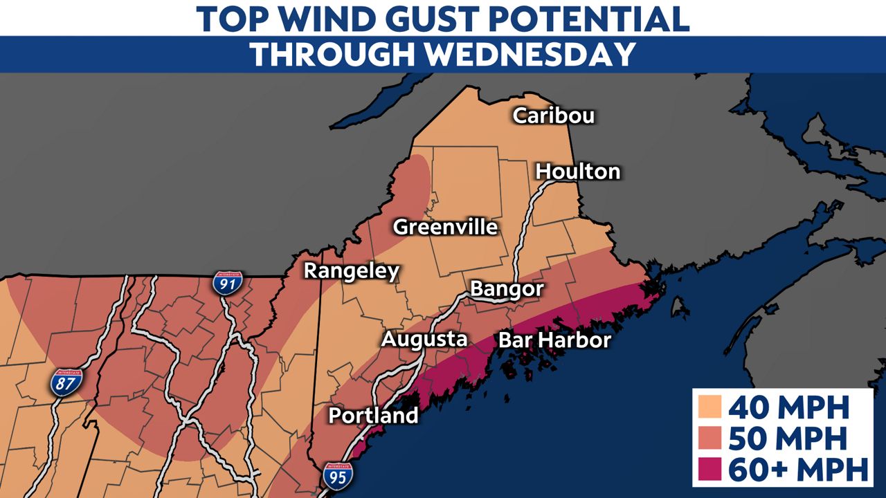
This storm will bring strong and gusty winds to the entire state, with the highest happening near the coast. High Wind Watches are already in place for those areas, where gusts could reach 60 mph. Favored locations Downeast could gust to 70 mph. Interior areas can plan on peak wind gusts of 40 to 50 mph.

The coast of western Maine should see its highest gusts happen Wednesday morning. The Downeast coast will see winds pick up Wednesday morning, with the highest winds coming late-morning through early afternoon.
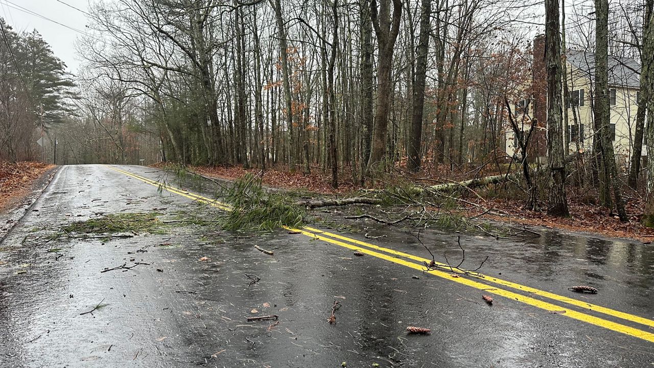
Some power outages are likely. Make sure your devices are charged by Tuesday night and you have flashlights and batteries on hand in case you lose power.
The powerful onshore winds are also forecast to cause at least minor coastal flooding due to storm surge. Peak surge will depend on how it times out with the mid-morning high tide.
Our team of meteorologists dives deep into the science of weather and breaks down timely weather data and information. To view more weather and climate stories, check out our weather blogs section.


