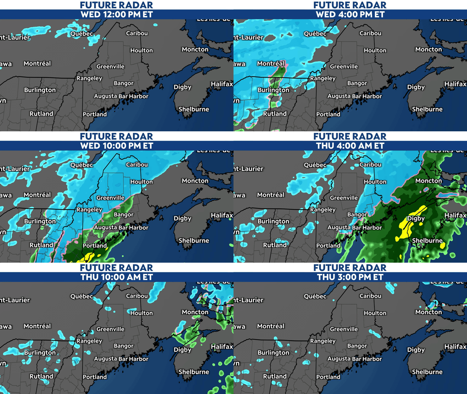
A fast-moving low pressure system will move across New England tonight, bringing widespread rain and snow through early Thursday.
Widespread rain and snow will move in from the south beginning later Wednesday evening. Precipitation will become widespread by 7 to 8 p.m., with snow beginning in the mountains first.
Parts of central Maine will see precipitation begin as rainfall, but change over to snow once temperatures drop tonight. Areas along the coast will see mainly rain through the entire event.

The good news is that widespread and impactful precipitation begins after the busiest Wednesday afternoon commute hours, and ends before the busiest hours of the Thursday morning commute. A few lingering snow showers are possible through midday Thursday.
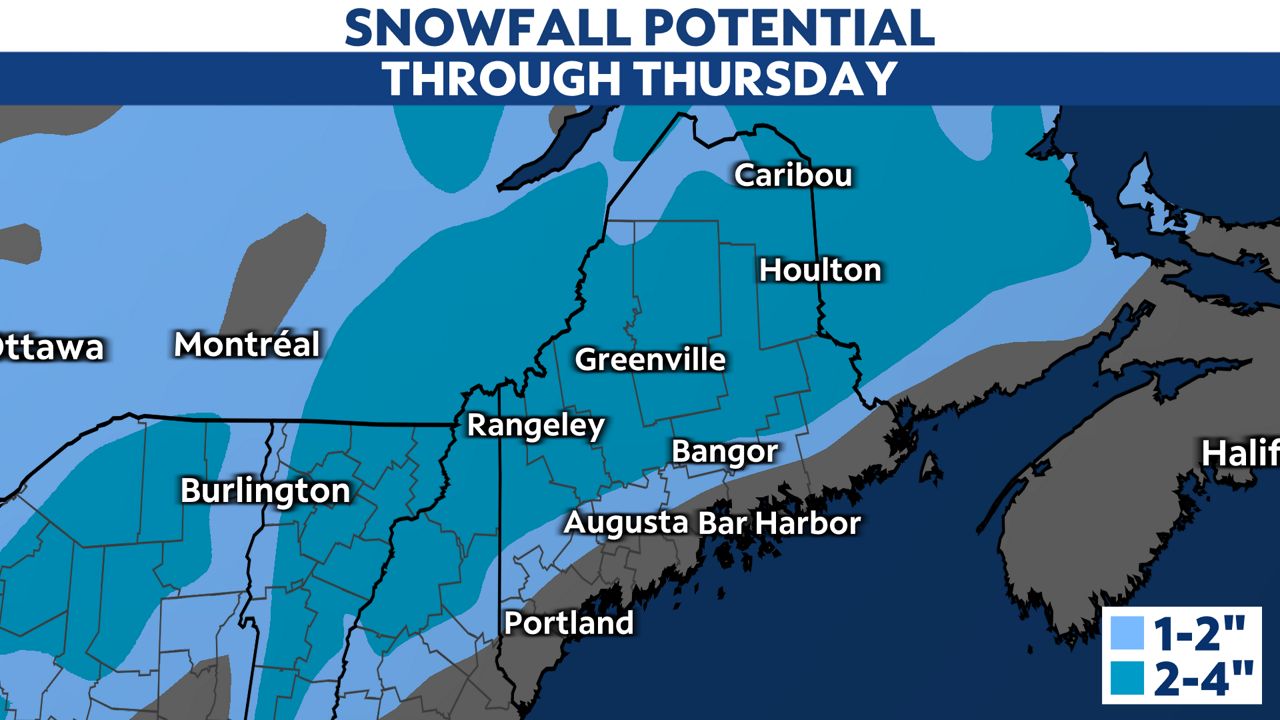
Snowfall totals will top out around 2 to 4 inches across most of interior Maine through Thursday morning, with the highest totals in the mountains. Closer to I-95, where precipitation begins as rain, totals will be near 1 to 2 inches.
Rainfall totals along the coast should top out near half an inch.

It will dry out through Thursday, and the next chance for scattered snow showers returns Friday night. Bitter cold moves in this weekend into early next week.
Our team of meteorologists dives deep into the science of weather and breaks down timely weather data and information. To view more weather and climate stories, check out our weather blogs section.


