A large storm system will bring heavy rain and strong wind gusts today through Thursday morning. Heavy rainfall and warm temperatures could lead to snowmelt, causing some flooding issues. Damaging winds will also increase the threat for downed trees and power outages later tonight.
This storm system will bring deep moisture by December standards. Warm temperatures and deep moisture will fuel heavy rainfall, prompting Flood Watches through Thursday morning for most of New England.
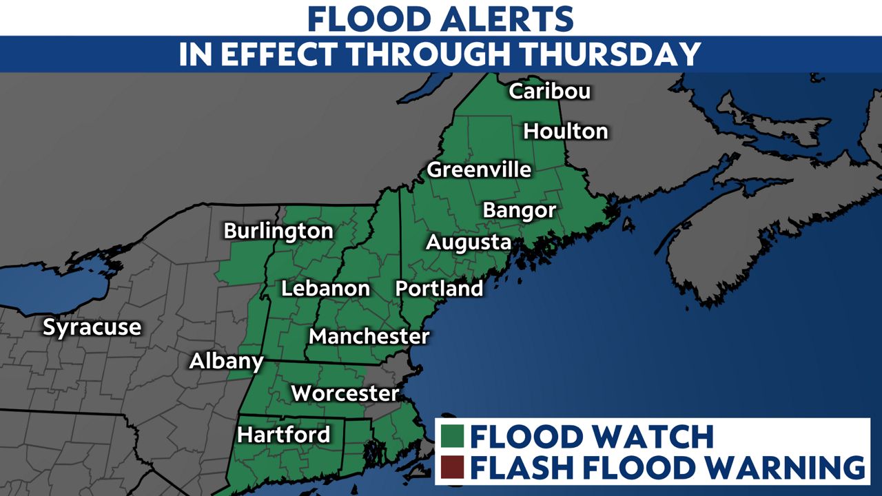
A warm front will lift north across the area tonight, bringing that warm and moist air to the region.
Although precipitation could begin as freezing rain or drizzle tonight, it will all transition to rain by daybreak. Rain will become more widespread and heavy throughout the day today.
Showers with intermittent downpours will continue through all of Wednesday.
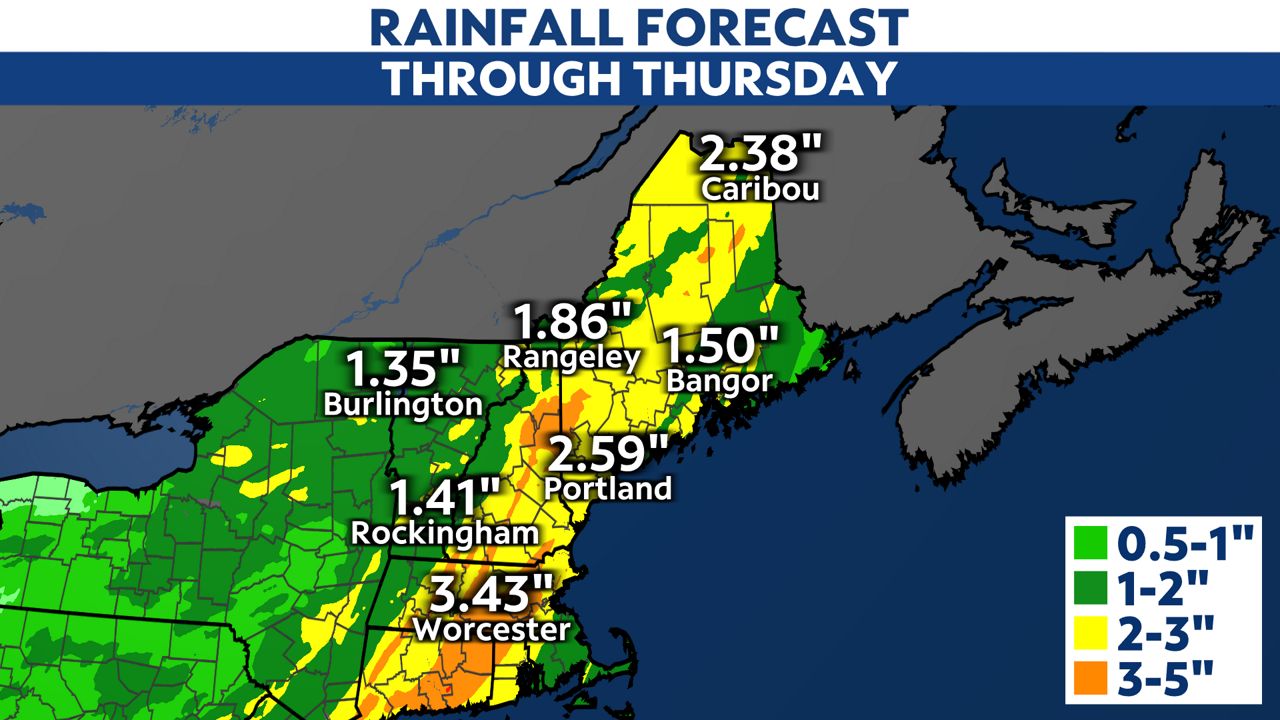
Rainfall totals will range from 1 to 3 inches across most of the state, but locally higher totals up to 3 to 5 inches are possible. Since temperatures will warm up into the 50s, it will cause snowmelt, especially for interior Maine, worsening local flood issues where the heaviest rain is.
Use extra caution on the roads throughout the day today.
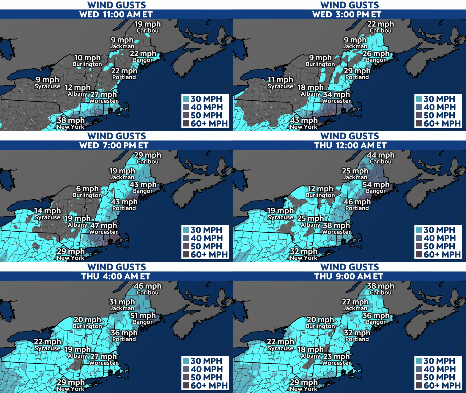
Strong winds will be an issue, especially near the coast as the storm system brings strong gusts late this evening. Wind Advisories and High Wind Warnings are in effect.
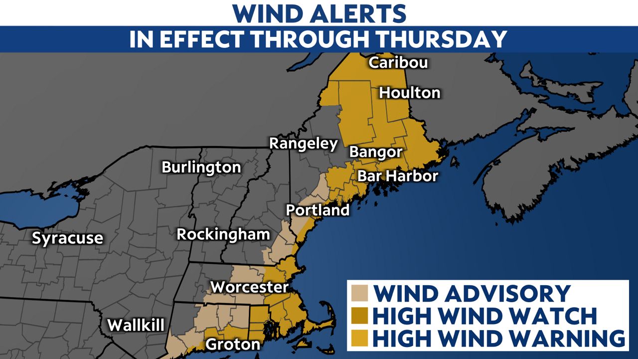
Wind gusts up to 50 to 60 mph are possible with peak gusts near 70 for some coastal areas. High winds will lead to downed trees and widespread power outages are expected along the coast later in the day and through the evening hours.
Scattered power outages are possible across parts of interior Maine and further north, with wind gusts up to 35 to 45 mph.
Drier weather and cold air return to the forecast through Thursday into this weekend.
Our team of meteorologists dives deep into the science of weather and breaks down timely weather data and information. To view more weather and climate stories, check out our weather blogs section.


