

Some of our April showers may be strong to severe as we begin a new month and a very active pattern.
What You Need To Know
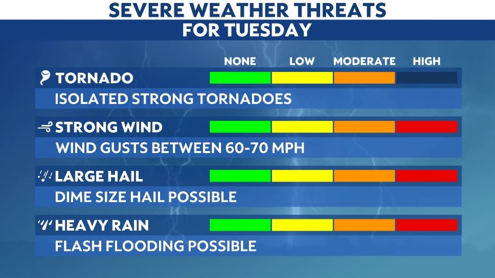
- Severe weather threat tonight with a significant threat Tuesday
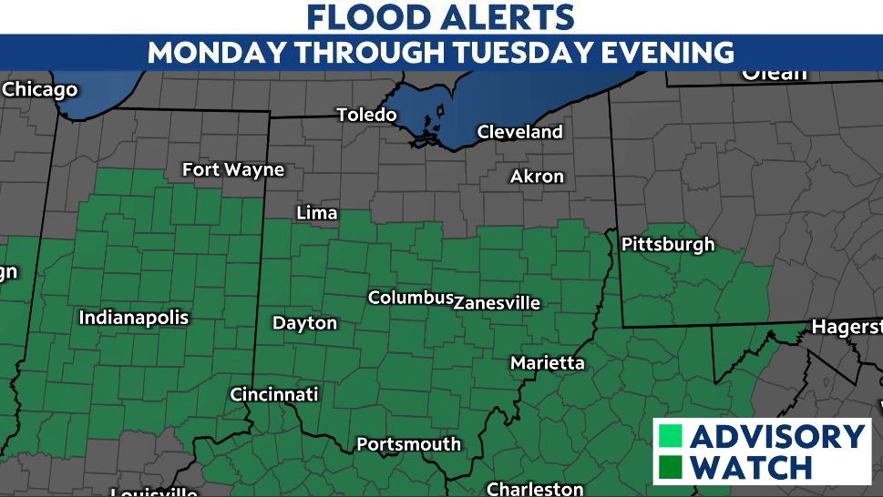
- Flooding is possible through Tuesday evening with 1-3 inches of rainfall
- Threat for tornadoes increases on Tuesday afternoon and evening
- Wednesday will be much cooler with a strong cold front
Showers and storms will spread in to the state from west to east through tonight. The rain may be heavy at times.
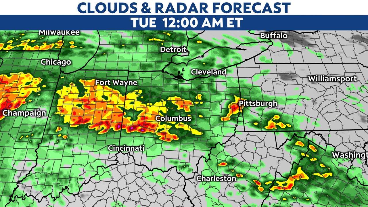
Some of the storms could be severe with damaging winds and large hail as the main threats.
The highest threat for severe weather is in southern Ohio.
Some thunder and downpours are possible overnight so expect a slower Tuesday morning commute with very wet roads and some ponding.
This model shows some very heavy rain and storms for during the commute.
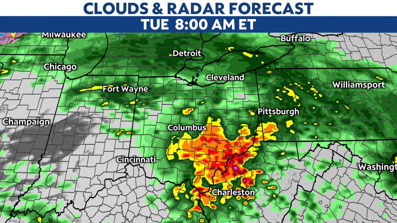
The severe weather threat becomes more widespread on Tuesday afternoon and evening with the highest chance near the Ohio River.
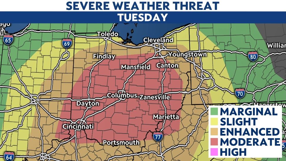
Storms may line up through the afternoon and evening which could lead to damaging winds higher than 60 mph and some tornadoes as well. A few strong tornadoes are also possible Tuesday.
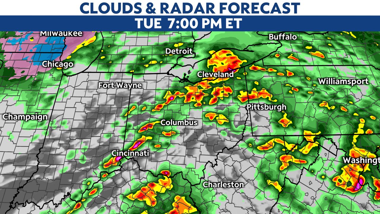
Prepare for severe weather through the late evening.
A very strong cold front will come in late Tuesday night into Wednesday.
This will keep showers in the forecast for Wednesday but really drop our temperatures for the rest of the work and school week.
We may even see some wet snow mixing in with showers Wednesday through Friday.
A Flood Watch has been posted for much of central and southern Ohio beginning this afternoon continuing through Tuesday evening.
Be on the lookout for quickly changing road conditions and never drive through a flooded roadway.
With limited vegetation growth and already wet soil, the forecast for multiple rounds of rain is expected to increase the threat for flooding.
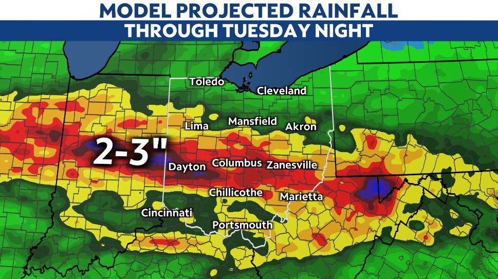
Rainfall amounts of 1 to 3 inches will be likely over the next three days across a good part of central and southern Ohio.
Those in flood-prone areas should monitor water levels of nearby creeks, streams and rivers. Much of the rainfall will quickly become runoff and may lead to fast rising water levels during and even shortly after heavy rain.
Tips to prepare for power outages
Make a kit
Try to include these items:
- Flashlights
- Extra batteries
- Portable radio
- Bottled water
- First-aid kit
- Nonperishable food
- A can opener
Our team of meteorologists dives deep into the science of weather and breaks down timely weather data and information. To view more weather and climate stories, check out our weather blogs section.