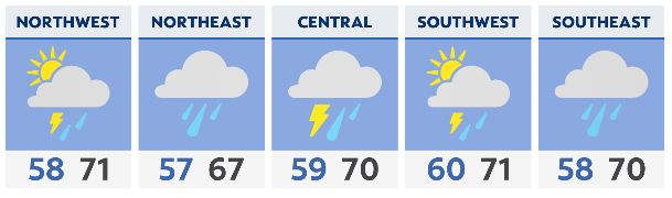
A few showers will be possible across northern Ohio for those Saturday evening plans. Otherwise it's a dry, mild and slightly breezy evening. A better chance of widespread light rain exists tonight into tomorrow.
A few pockets of heavier rain and a rumble of thunder will be possible. However, no severe weather is in the forecast tonight or tomorrow morning. Some breaks in the rain will occur tomorrow afternoon, allowing most of the state to approach or exceed 70 degrees.
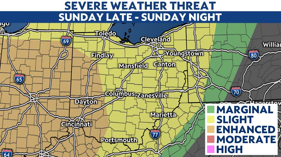
This part of the forecast will be key in determining the extent of the severe weather threat later Sunday into Sunday night. If more sun and warmer temperatures are observed, the risk for severe thunderstorms will go up. If it stays cloudy and rainier than expected, that risk will be lower.
For now, we're continuing to advertise a risk for severe thunderstorms capable of damaging wind gusts, large hail and spin-up tornadoes. The overall threat is highest across western Ohio. Timing looks to be late in the afternoon to just after midnight as a line of storms moves eastward.
Some leftover light rain will be around early Monday before things dry out in the afternoon as colder air moves in from the northwest. Highs Monday will occur in the morning with falling temperatures during the day.
Tuesday will be a dry and cool to chilly day before a very active pattern takes over. Multiple rounds/waves of rain, downpours and thunderstorms are expected between Wednesday afternoon and next Saturday.
This will result in a flood risk, especially across central and southern Ohio. The potential exists for several inches of rain to fall over a 4-day stretch starting Wednesday. There could also be another risk of severe weather Wednesday into Wednesday night. Stay tuned!