We have not spent many hours above freezing so far this year in eastern North Carolina. In fact, the first week of the year has been the coldest start to a new year on record for Wilmington. Those records date all the way back to 1871.
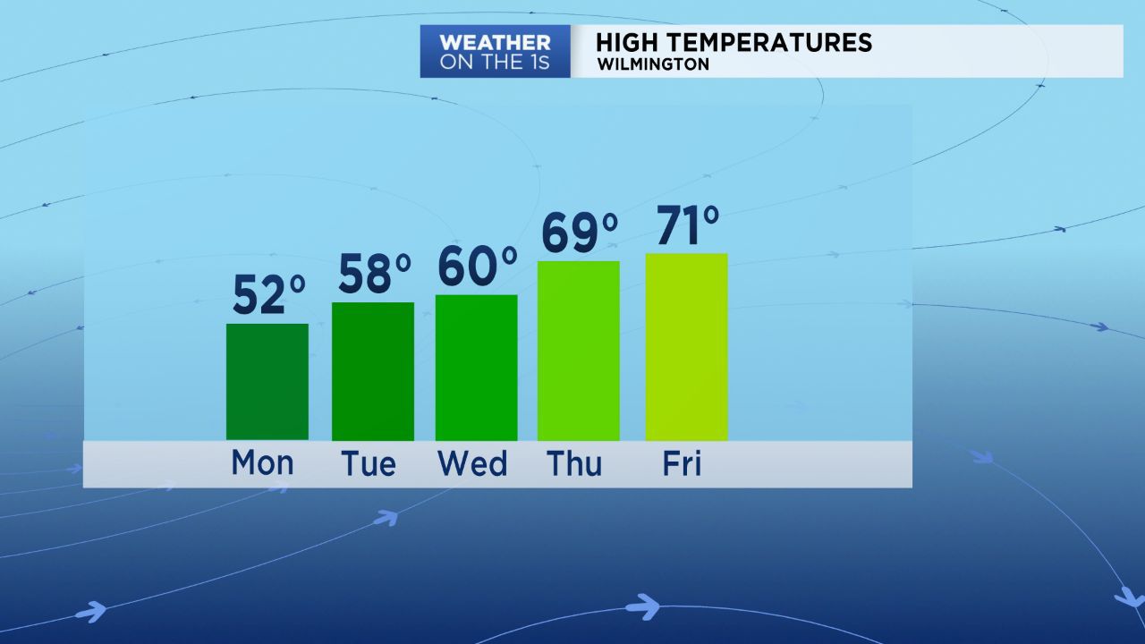
This week will be nearly as frigid though. The warm up begins Monday afternoon with highs in the upper 40s to low 50s across much of eastern North Carolina.
It is important to note that the western half of the state from north for Charlotte around Greensboro to the mountains is under a Winter Weather Advisory for Monday. Light freezing rain or a freezing drizzle could leave a light icy glazing on that part of the state at times today.
Most of Monday will be dry here in eastern North Carolina. A few sprinkles of rain are possible in the evening mainly north of Wilmington and Jacksonville.
Monday will likely end up being the coolest afternoon of this week. Highs will top out in the 50s on Tuesday. By Thursday and Friday, much of the region will be near 70!
Our next chance for measurable rain will come along with those warmer temperatures. Look for showers around the region at times on Thursday and Friday.