
The winter storm warning has ended for New York City. While a scattered light snow shower remains possible, these won't bring any further accumulation.
Some parts of the city have pushed double-digit snowfall, including Central Park.
While the nor'easter is over, it was a solid opening thumper from Mother Nature this winter.
According to NY1 Chief Meteorologist John Davitt, "This is the biggest December snowfall since 2009, when we recieved 10.9 inches that year."
It also doubled New York's total winter snowfall from last year, with 10.5 inches at Central Park.
After heavy snowfall and a period of sleet Wednesday night into early Thursday morning, all has ended. While a spotty snow shower may swing through this evening well east of the city, any additional snow won't amount to anything.
Remember that streets and highways will take time to improve. Davitt cautions that with such a wet snow, shoveling will be extra taxing. "Take your time with the clean up. It looks like a heavy wet snow for the southern half of the city."
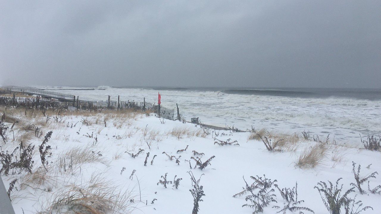
Winds remain stiff, especially closest to the shore. Wind gusts are still topping 30 mph.
Breaking waves of 6 to 10 feet will cause erosion on Atlantic-facing beaches of Long Island into the afternoon. Coastal flooding is also likely with two feet of inundation, possibly more.
Central Park picked up 10.5 inches of snow, while 10.1 inches fell at LaGuardia and 7.2 inches fell at JFK.
Check out some of the totals around the state.
Stay with NY1 for the latest on this winter storm.