


Temps now:

Our next cold front is on the way! We're tracking a storm system over the Pacific Northwest, bringing wintry weather to the Cascades and northern Rockies today, moving east into the Midwest into Sunday. High pressure aloft will move to the east, and at the surface a cold front moves through by Sunday afternoon with a 40% rain/storm chance. Cooler and drier air will move in behind the front, setting up a nice fall like start to next week.
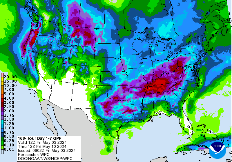
This front looks to be more of a wind maker instead of rain maker, just like our front this past week. NOAA's 7 day rain outlook shows 0.10-0.25 inches possible across South Central Texas.
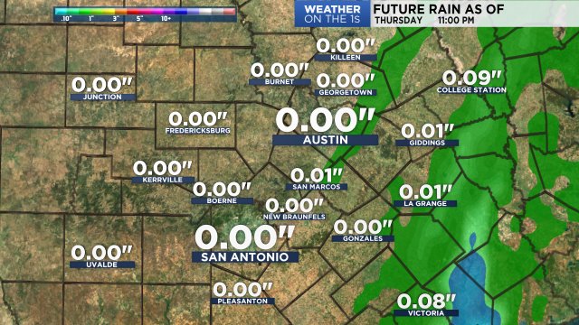
Our model shows future rain totals through late Sunday:
Saturday will be just as warm as today in the upper 80s to low 90s, but we're much cooler behind the front Sunday in the 60s and 70s. It stays cool and comfy in the 70s through Tuesday, warming into the low 80s by Wednesday and Thursday, and back above normal in the upper 80s by Friday. Plan ahead here with the 7 day forecast.
Enjoy the rest of your Friday!