


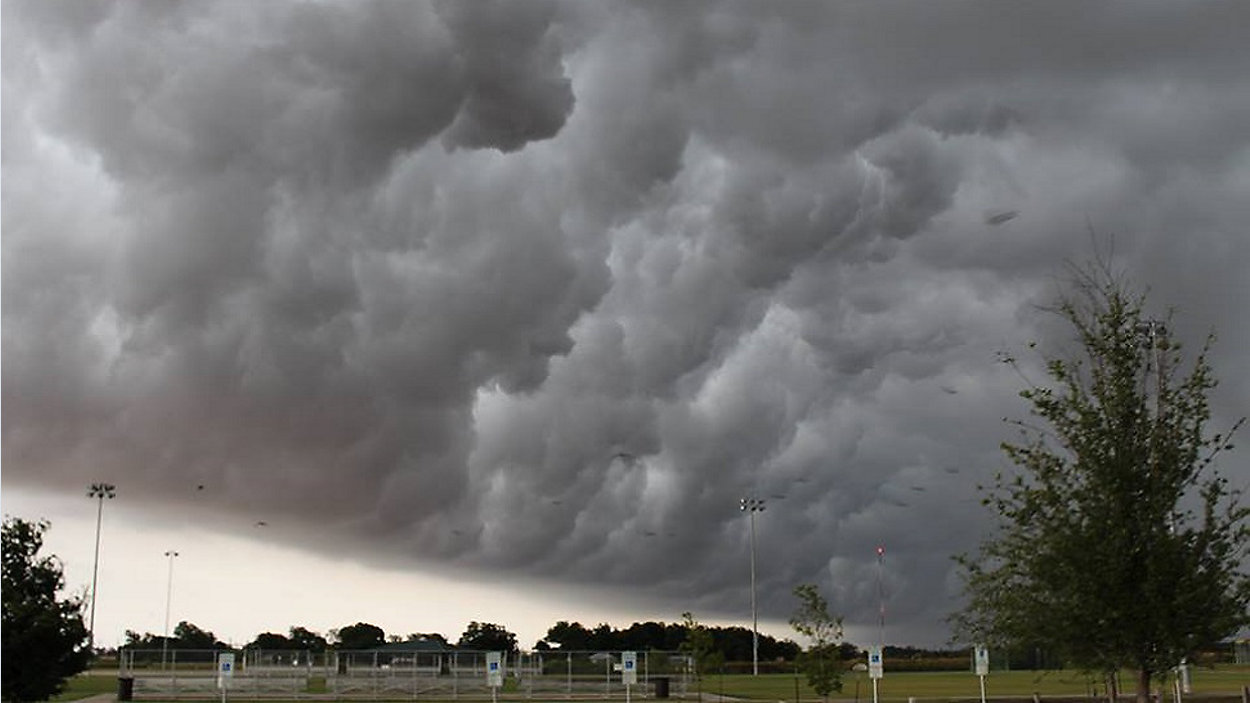
For the first time since spring, our stretch of the I-35 corridor is under a SLIGHT RISK for severe storms and the radar is already lighting up. Stay weather-aware today! The forecast calls for an overall 70% chance of showers & storms, with afternoon high temps in the low to mid 80s.
Current Conditions | Satellite & Radar | Travel Maps
7 Day Forecast | Allergy
Futurecast shows a squall or band of storms moving from west to east across the Austin area today, delivering heavy downpours that could be blinding to drivers. And, as with any thunderstorm, there will be a threat of lightning. But we'll also be on the lookout for some possible hail, potentially damaging storm winds, and the threat of isolated tornadoes.
Our latest models show the heaviest rain moving through Austin during the afternoon hours then it'll shift east during the evening.
Cooler, drier air from the north will follow this front, allowing temps to drop well into the 60s overnight. We'll barely make it into the 80s tomorrow as another, reinforcing surge of dry air arrives from the north. It'll end up even cooler at sunrise Thursday and Friday morning, with daybreak temperatures in the low 60s in town and a range of 50s in the suburbs and Hill Country.
We'll enjoy some sunshine and dry weather for a few days before another cold front comes sweeping through the Lone Star State this weekend. It looks to bring notably cooler autumn air into the picture starting Sunday.
Join us for the very latest on 'Weather on the 1s' as we track the rainfall. We'll be on TV or the live stream every 10 minutes.
WEATHER ON THE GO: Download the Spectrum News app and watch our live stream no matter where you are!
GET WEATHER ALERTS: Sign up to receive weather text alerts from the Spectrum News Weather Team
Enjoy the weather!
--Chief Meteorologist Burton Fitzsimmons (@Burton_Spectrum)