


We're up to twelve days in a row of rainfall around the region and there's more on the way, with help from a player in the Gulf of Mexico.
A "blob" of disorganized storms, or "tropical entity" as we've been calling it, could actually become a true Tropical Depression today -- experts at NOAA's National Hurricane Center now give it a 50% chance -- before crashing the West Gulf coast tomorrow.
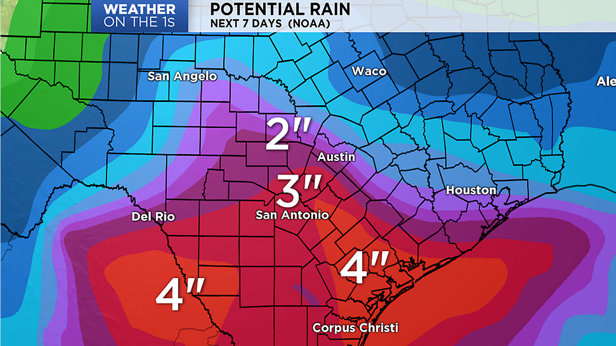
No matter what call it, heavy rain looks to be the outcome. The forecast calls for potential 1" to 2" totals around Austin and maybe some heavier 2" to 3" totals in the San Antonio area, with heavier accumulations possibly creating flash floods further south and west of the Alamo City.
In the above video, Chief Meteorologist Burton Fitzsimmons shows us the latest satellite and radar imagery, and gives us an update on where computer models suggest it'll all go.
As the forecast could change quite a bit during the next 24 hours, be sure to watch 'Weather on the 1s' on TV or via the live stream for the very latest.