


We are just winning the lottery with some wonderful spring days in Central Texas. We saw partly cloudy skies today with some breezy south winds and temperatures in the upper 70s and low 80s. This is several degrees above our normal March high temperature of 74 degrees but I'm not complaining. This weather will continue through the weekend and then some much needed rain will head our way next week.
Current Conditions | Satellite & Radar | Travel Maps
Allergy | 7 Day Forecast | Twitter
Highest Wind Gusts:
35 mph - Temple
32 mph - Austin-Airport
30 mph - Killeen
30 mph - Kerrville
29 mph - Georgetown
29 mph - Austin-Mabry
29 mph - Burnet
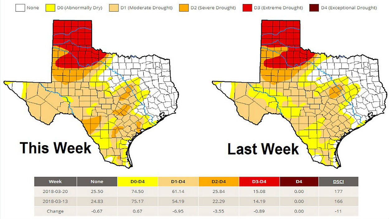
A ridge of high pressure over Mexico has been our dominating weather feature the last few days. It has been sending some high thin cirrus clouds over the area from the northwest but now our surface winds have turned from the south and this will pump moisture into the region in the form of higher dew points, more humidity and more cloud cover. Clouds will increase tonight with an overcast sky when we wake up. The high will move across Texas on Friday and this will open the door for our next storm system to approach the Lone Star State next week. As of right now, the forecast has the storm system stalling out for several days keeping a 30% - 60% rain chance around through the end of the week. This is awesome news for us since the latest Drought Monitor has put us into the Severe category for parts of Central Texas.
Stay tuned and we'll keep you posted on the potential rain.
Meteorologist Mary Wasson
Follow me on Twitter, Facebook and Instagram!