


Today is another day of temperatures that were already above the normal shortly after sunrise. Most highs this afternoon will rise to the lower/middle 80s with a strong south wind.
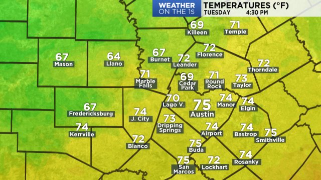
Current temperatures:
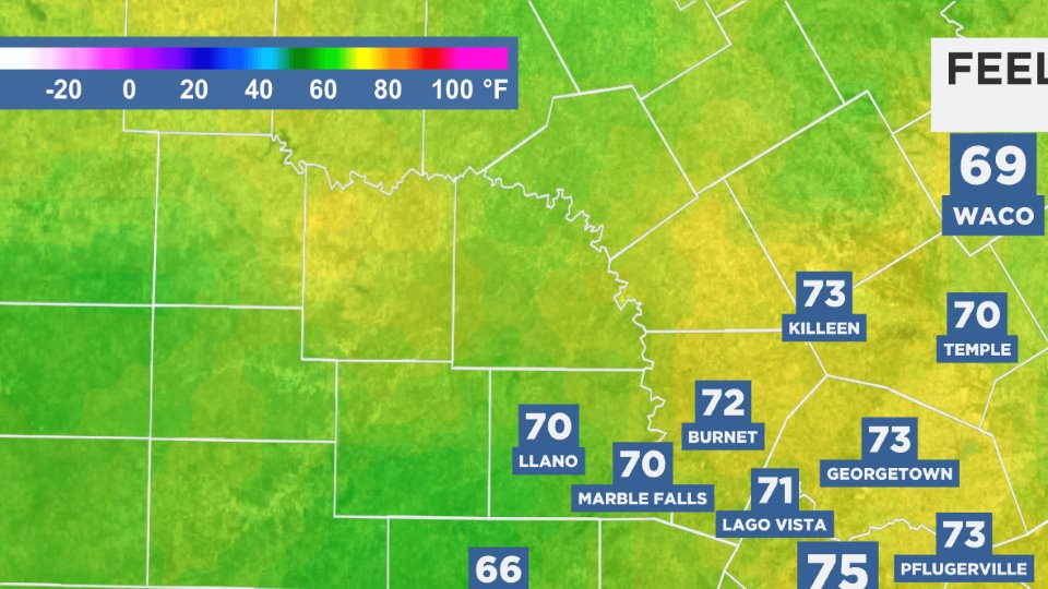
Dew point temperatures remain in the middle/upper 60s making it feel like:
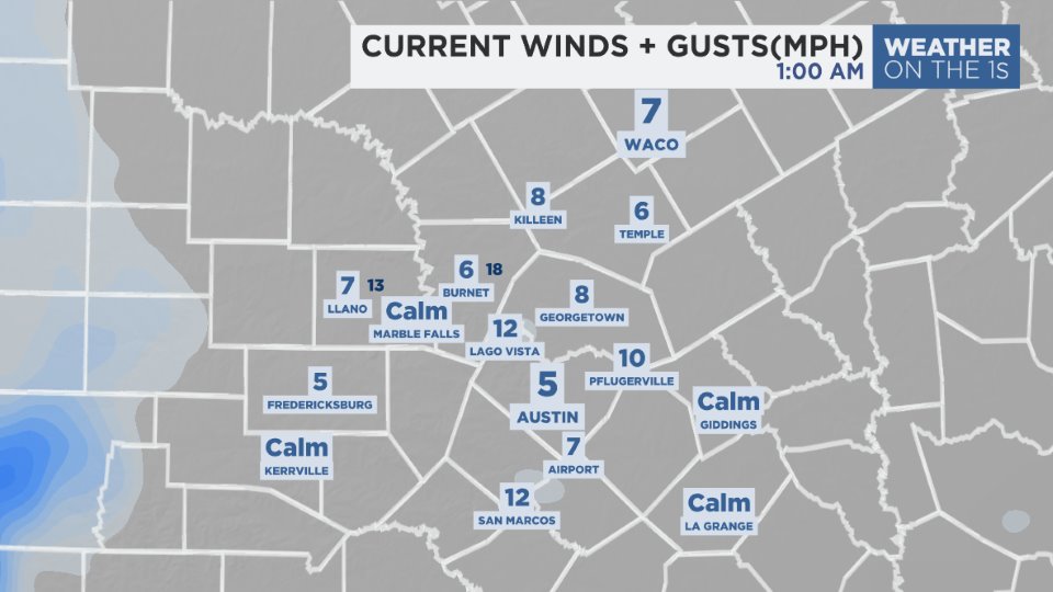
Current winds:
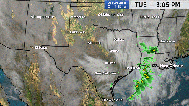
The day dawned with an overcast sky and lows that were as much as 15 to 20 degrees above normal. Slow clearing took place in the Hill Country during the morning ... a clearing that will continue this afternoon.
The next cold front will arrive Saturday morning. The day will dawn with an overcast sky with daybreak temperatures in the middle to upper 60s. The front will pass around 9 to 10 a.m. with a strong north wind left behind along with decreasing clouds. Wind speeds will climb to the 15 to 25 mph range ... with some areas as high as 20 to 25+ leading to gusts in the 30s.
Highs for the day will occur around noon to 2 p.m. in the middle to upper 70s. Temperatures will fall to the 40s by midnight, bottoming out in the low to mid 40s Sunday morning. Sunday afternoon will be bright and cool. A northeast wind and highs in the low to mid 60s are expected.
Monday morning will be coldest ... upper 30s to low 40s.
Another change comes before the holiday. A cold front arrives Wednesday morning with a little rain and another drop in temperatures. Thanksgiving Day will be nice and cool under a bright sky.
Your 7 Day Forecast has the Black Friday outlook.
Enjoy your weekend.