


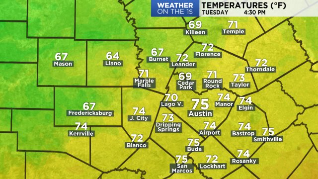
After a few near record high days, we are looking forward to our next cold front which will move across our region by this evening. You'll notice the front moving in once the winds shift from south to north and they pick up between 10 - 20 mph. Temperatures will also drop from the upper 70s and low 80s, into the low 60s by 9 pm.
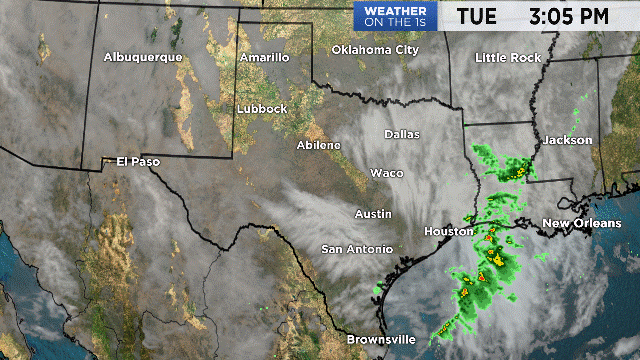
Current Texas Temperatures:

Current Central Texas Temperatures:
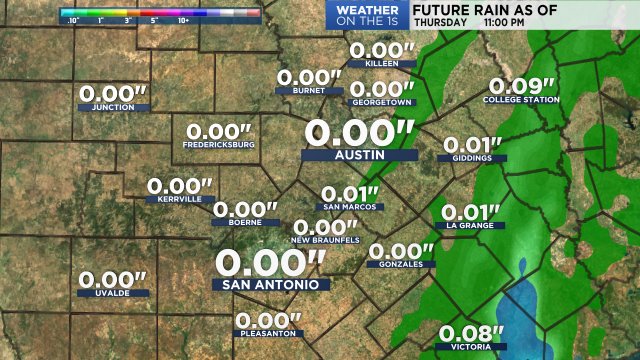
No rain is forecast with this front but another area of low pressure will swing across the state on Wednesday and this will lead to widespread rain across the Hill Country and along the I-35 corridor. Rain chances will go up overnight and eventually to 60% by Wednesday afternoon.
Temperatures overnight will drop into the mid 50s but will not warm up on Wednesday. In fact, some forecast models suggest that temperatures will hold steady in the low to mid 50s through the day and then dropping into the 40s just before sunset Wednesday evening. This will make for a very chilly rain so be sure to dress accordingly.
Texas Futurecast:

Regional Rain Totals:
High pressure will build in overhead later this week with temperatures slowly moderating on Thursday and Friday.
Check out all the details on you 7 Day Forecast.
Thanks for stopping by and enjoy the cooler air!