


After reaching into warm low to mid 80s today, a cold front will sweep across Texas tonight to make it feel even more like fall in the days ahead. It's a dry front and there will likely be another on Friday, setting the stage for an even cooler weekend this time around. Plan for lots of sunshine all week long.
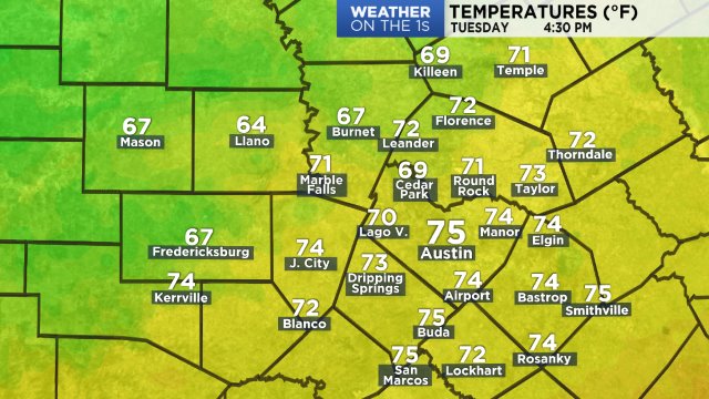
Metro Austin hit a high of 80 yesterday at 2:39 p.m. Now:
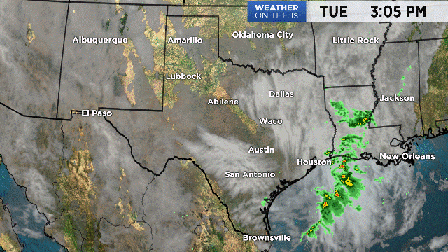
Our in-house Futurecast model shows the front arriving around 2 to 4 a.m. and with very little fanfare. The air's too dry to support any clouds, much less rain. Cooler north breezes will push through the area while most area sleeping tonight. Forecast low temps:

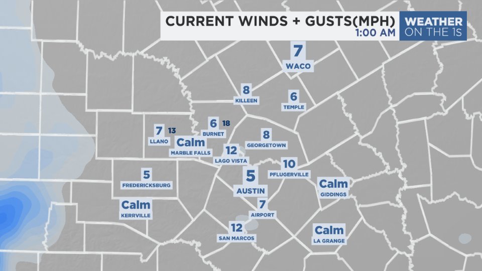
Northerly winds will turn breezy tonight through tomorrow, with sustained winds around 5 to 18 mph and gusts above 20 mph possible especially during the first half of tomorrow.
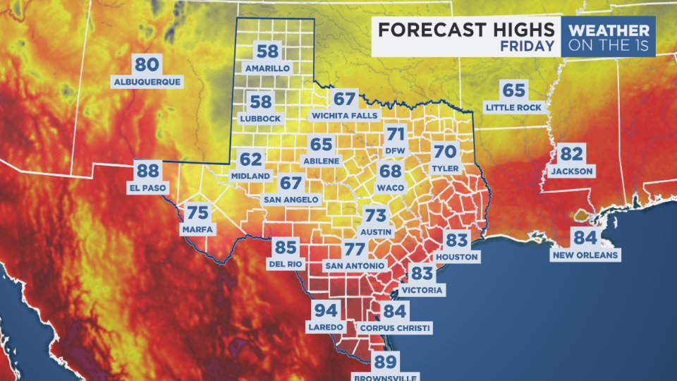
We're planning for widespread 40s Tuesday night/Wednesday morning at the coldest this work week. Daytime temps will warm back slightly above the normal 80 by Thursday before yet another cold front moves our way, currently timed to arrive first thing Friday morning. As of now, it appears to arrive without any rain and could pack more of a punch. Daytime highs will dip back to 60s Friday and Saturday, we believe, and just barely get back above 70 on Sunday. This coming weekend, plan for colder overnight 30s and 40s and what could possibly be light frost/freeze in the protected valleys of the Hill Country. See the 7 Day Forecast for more.
Growers be aware: the first freeze of the year hits the Hill Country around November 12th and metro Austin near December 2nd on average over the past 60 or so years. The earliest on record? On October 26, 1924, metro Austin hit 31.
The long range forecast calls for cooler-than-normal and drier-than-normal weather for Texas for the rest of the month.
Enjoy the weather!
--Chief Meteorologist Burton Fitzsimmons (@Burton_Spectrum)