


After a cloudy start with areas of patchy fog, the afternoon brings more sunshine and a few spotty showers east of 35. Highs will make it into the low to upper 80s, winds will be breezy at times out of the southeast. Rain chances are small today at 20%, but will increase to 70% overnight as our next front moves in before sunrise.
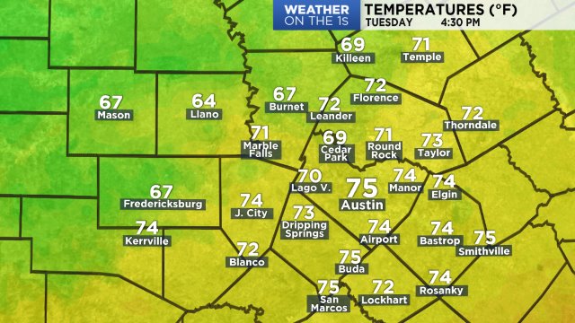
Temps now:
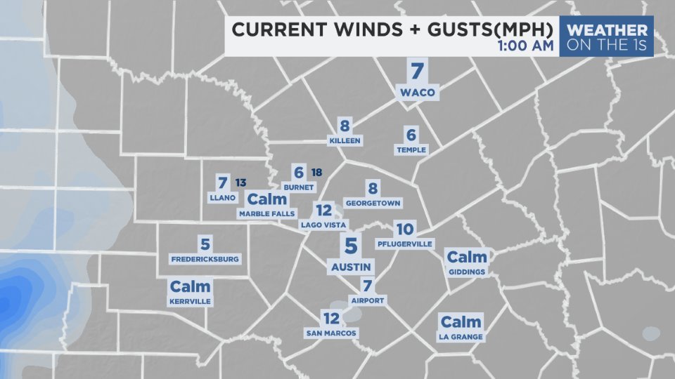
Winds:
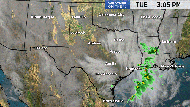
Showers are developing over the western Gulf of Mexico this morning, and will continue drifting north and inland today, giving a better chance for rain along and east of 35. Our next front moves into the Panhandle by noon, then into the Metroplex by midnight. The Storm Prediction Center highlights a chance for strong to severe storms across North Texas as the front arrives. A SLIGHT to ENHANCED RISK for storms with strong winds, large hail and isolated tornadoes includes covers the Red River, including areas like Dallas, Forth Worth and Wichita Falls.
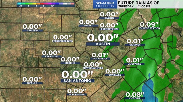
This front brings a better chance for measurable rain for Central Texas, but the flood threat is low because the front moves through quickly. A few areas may pick up over 1 inch of rain, but on average it looks like totals will range from 0.25 to .85 inches. Our model shows:
The front clears by late morning Sunday, behind it cool and dry air moving in on the heels of a gusty north wind. Skies clear from north to south pretty quickly, plan for sunshine and cooler 70s for Sunday afternoon. Temps will likely drop a quick 10-15 degrees behind the front with mostly 60s by 10 AM, and feeling more like upper 60s to low 70s by late afternoon. Monday morning looks chilly with clear likes and temperatures in the upper 40s to low 50s. Next week brings two more dry cold fronts, the first arrives Monday into Tuesday, the second by Friday. These fronts will reinforce cool and dry conditions, so that fall feel looks to last a little longer.
Plan here with the 7 day forecast.
Enjoy the rest of your Saturday!
-Meteorologist Emily Borchard