


Moisture moves across Texas today in the form of clouds, and there might even be a little bit of brief rain, too. Overall, it's a low 20% chance for showers & storms out there today with mostly to partly cloudy skies and highs in the low to mid 80s. The odds bump up to 30% tomorrow then 50% by first thing Sunday with another cold front.
Metro Austin hit a high of 83 yesterday at 2:52 p.m. Now:
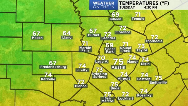
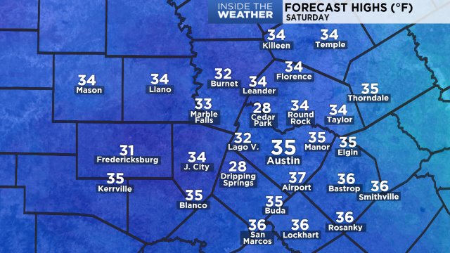
Today's forecast highs:
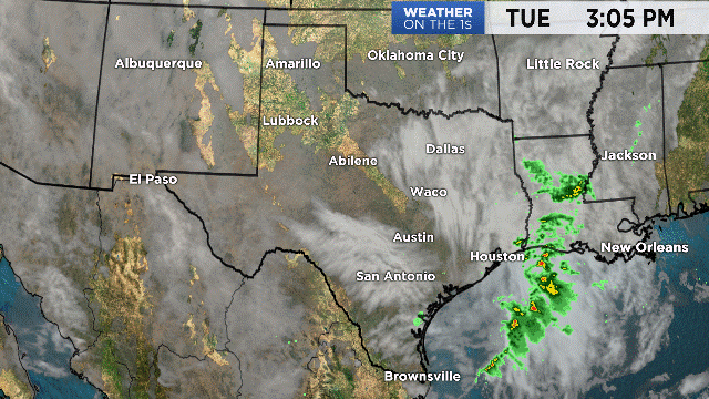
The satellite/radar loop shows lots of cloud cover but no rainfall, at least not yet. Our Futurecast model indicates a few spotty showers today and that's about it. A trough of low pressure to our west will bring a "shortwave" of energy across Texas tomorrow with a slightly better 30% shot for rain and possibly some brief thunder.
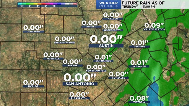
Skies will remain fairly cloudy through Saturday (20% rain) then we'll see loads of sunshine for the second half of the weekend behind another moderate intensity cold front. It's currently timed to arrive in Austin around or shortly after daybreak with a decent 50% chance for showers & storms, all of which should move through fairly quickly. Clearing will begin immediately after, with lots of sunshine and cooler north breezes to enjoy on Sunday afternoon. Looks like pretty good timing for this year's Formula 1 activities out at the COTA track! As for temps, plan on a hot and humid day Saturday. We'll likely be in the upper 70s at the 11 a.m. kickoff for the Longhorn game but it'll feel even warmer. Afternoon highs in the upper 80s could feel like low 90s. Sunday, on the other hand, will be much more comfortable and humidity levels will drop quickly behind the front. See the 7 Day Forecast for more and plan your activities accordingly!!
Enjoy the weather!
--Chief Meteorologist Burton Fitzsimmons (@Burton_Spectrum)