


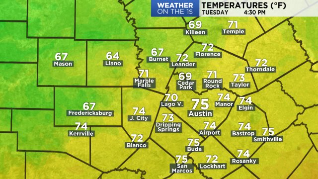
Autumn is, for many, the favorite season. So, the weather Monday and today is just perfect for fall lovers.
During Weather On The 1s Sunday night we mentioned that it's normally the second morning after a cold front passes that is typically the coldest. That was certainly the case this morning after Sunday's cold front. The low at Austin-Mabry was 50 degrees, the coldest low since 48 on April 24. The low at the airport was 43, the coldest since 43 on April 7.
The coldest air Tuesday morning was in the Hill Country:
34 Fredericksburg 10 WSW
37 Dripping Spring 2 SSW
37 Johnson City
37 Spicewood
38 Jonestown
39 Bertram 8 SSW
39 Driftwood 4 SSE
39 Jollyville 2 SW
39 Marble Falls
40 Elgin 8 NW

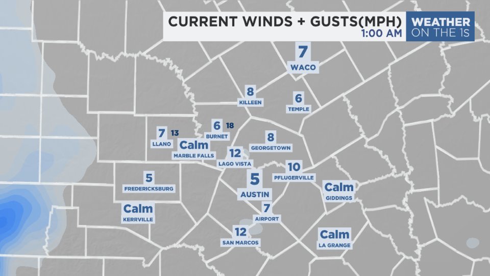
At this time:
Wind speeds are much lower today. The wind is variable east but it looks like more of a southeast wind comes back in some area this afternoon.
At this hour:
Upper-level high pressure is centered over the Baja Peninsula. It is drifting east. This provides a dry northwest flow aloft leading to this sunny day.
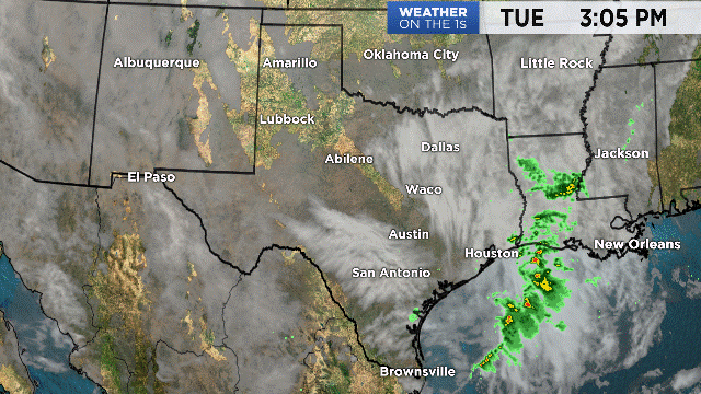
The high will be over Texas Wednesday and Thursday before landing in the southeast United States Friday. Trailing behind is a weak upper-level low trough that will pull in enough moisture for a low chance of rain Friday and Saturday. For now, rain totals during those two days are predicted to be under .10" at most locations.
Another late weekend cold front arrives Sunday morning. Present trends show it moving through between 3 and 9 a.m. with more rain and possible thunderstorms. Some areas are forecast to pick up as much as .50" during the Sunday morning rain.
The temperature effect of the front is found on your 7 Day Forecast.
Have a good day.