


The cold front arrived at Austin-Mabry between 9 and 10 Sunday morning. The rain was very scarce in isolated areas:
.04" Willow City
.03" Blanco 13 WNW
.02" Cow Creek near Lago Vista
.01" Cedar Park
.01" Fredericksburg 9 SW
Strong breezes followed the front with these peak gusts:
35 mph Temple
31 mph San Marcos
31 mph Lago Vista
31 mph Killeen
30 mph Pflugerville
30 mph Burnet
29 mph Austin-Bergstrom
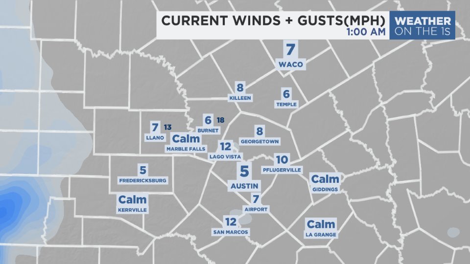
Wind now:
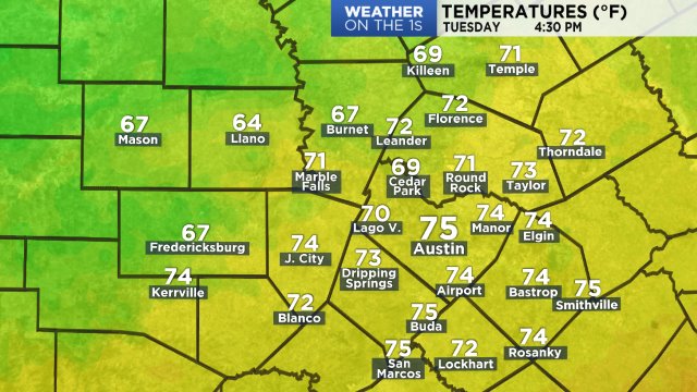
Temperatures peaked this afternoon in the upper half of the 70s at most locations:

At this hour:
Overnight low temperatures will drop to the lower 50s at many locations Monday morning. The north wind around 10 mph will make it feel like some 40s in the suburbs and Hill Country. Look for a sunny sky Monday afternoon with most highs in the low to mid 70s. The wind will continue out of the north 5 to 15 mph.
The second morning after a cold front is usually the coolest so look for that Tuesday morning with lows forecast down to the middle to upper 40s.
High pressure in the upper atmosphere will keep the weather dry through Thursday. Clouds will be increasing by then ahead of an upper-level trough that glides across Texas Friday and Saturday leading to a low rain chance. The next cold front is scheduled to arrive Sunday with a slightly better chance of rain.
Afternoon highs return to the 80s as early as Wednesday. The details are noted on your 7 Day Forecast.
Have a good week.