


We're can not only feel the higher humidity out there this morning, we're saw the evidence of it in the form of fog at daybreak. Low clouds continue to evaporate away, leaving us with a bright and hot afternoon. It'll be hot tomorrow, too, but Sunday turns cool thanks to a fall cold front...which looks to be arriving earlier than expected, possibly with a few storms.
Metro Austin hit a high of 88 yesterday at 2:44 p.m. Now:
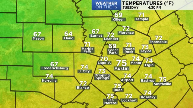
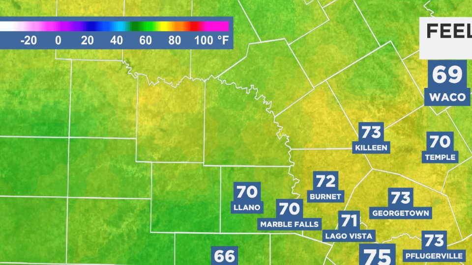
The heat index will peak around 91 to 95 today. At this hour:
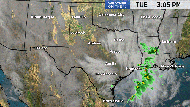
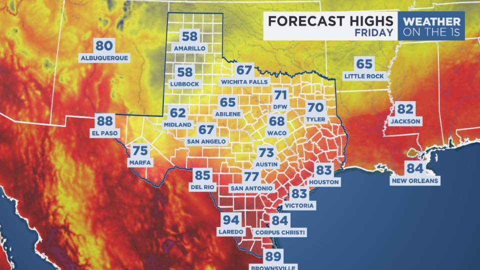
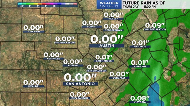
Upper-level high pressure centered over the Deep South will influence our weather through tomorrow before diminishing. Futurecast shows mostly clear skies late today through early tonight, then low clouds and fog will once again form and make for a gray start to Saturday. We expect them to clear out midday, leaving another fairly bright & hot afternoon. Meanwhile, cool air is set to rush from the Rockies to the Plains during the weekend, and our latest computer models now show that cooler air racing into Texas a bit faster than previously noted. Futurecast shows the cold front moving into our northern communities around sunrise Sunday then sweeping through Austin during the mid-morning, clearing the I-10 corridor before noon. We're looking at better 50% odds for showers & storms but they'll likely be brief and confined to the morning hours. And we're not expecting much...maybe a half inch at the very heaviest:
Dry north winds will bring the feel of low 70s Sunday afternoon, then we're heading back into cool 50s for several mornings next week. It looks comfy! See the 7 Day Forecast for details.
Enjoy the weather!
--Chief Meteorologist Burton Fitzsimmons (@Burton_Spectrum)