


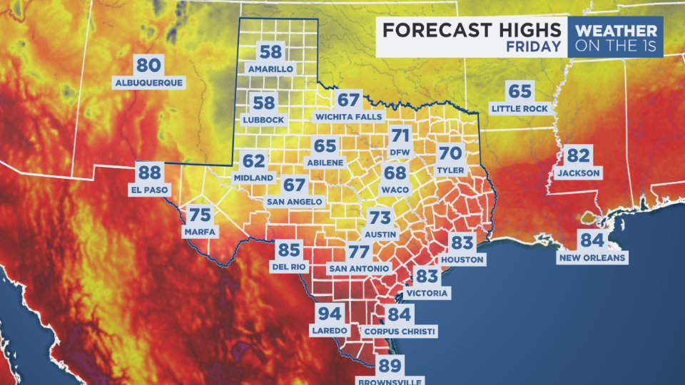
Winds of change once again blow across Texas! This time, it's the humid breeze from the Gulf of Mexico taking charge once again, bringing back the warmth and humidity we know only too well. Our forecast calls for fairly bright skies this afternoon with highs in the mid 80s, and we're heading back to near 90 tomorrow and Saturday. Another fall cold front looks to come through the Lone Star State on Sunday, maybe with some October showers.
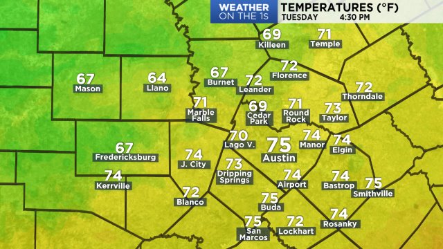
Metro Austin hit a high of 80 yesterday at 3:08 p.m. Now:
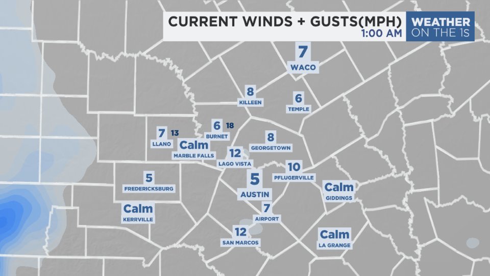
We've enjoyed dry, northerly winds since early Tuesday morning. Now, the south-southeasterly breeze is coming back. Wind speeds are expected to hold below 10 mph at the strongest today. At this hour:
Plan for a mix of sun and clouds this morning, transitioning to a mostly sunny sky much of the afternoon.
Upper-level high pressure continues to dominate the deep south, centered just to our east. Computer models show the ridge holding strong through the early hours of the upcoming weekend before moving off to the east towards Bermuda. A jet stream pattern shift will allow a pocket of cooler air to travel out of the Rockies into the Southern Plains, and it's currently timed to arrive here by Sunday evening. At least a couple of our models show mostly cloudy skies for the second half of the weekend with rain developing along the front as it sweeps northwest to southeast through the Lone Star State. There might be a few rumbles of thunder out there, as well. For the most part, the latest models hint at this being a rather light rain event for our region:
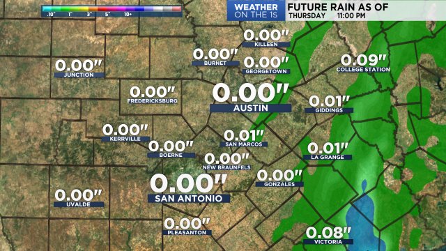
That is, of course, subject to change! For comparison sake, NOAA's latest rain outlook suggests potential accumulations of around 1/4" to 1/2" here at home between now and next Thursday, almost all of which would fall on Sunday. See our 7 Day Forecast for more about the impact on temperatures.
Enjoy the weather!
--Chief Meteorologist Burton Fitzsimmons (@Burton_Spectrum)