


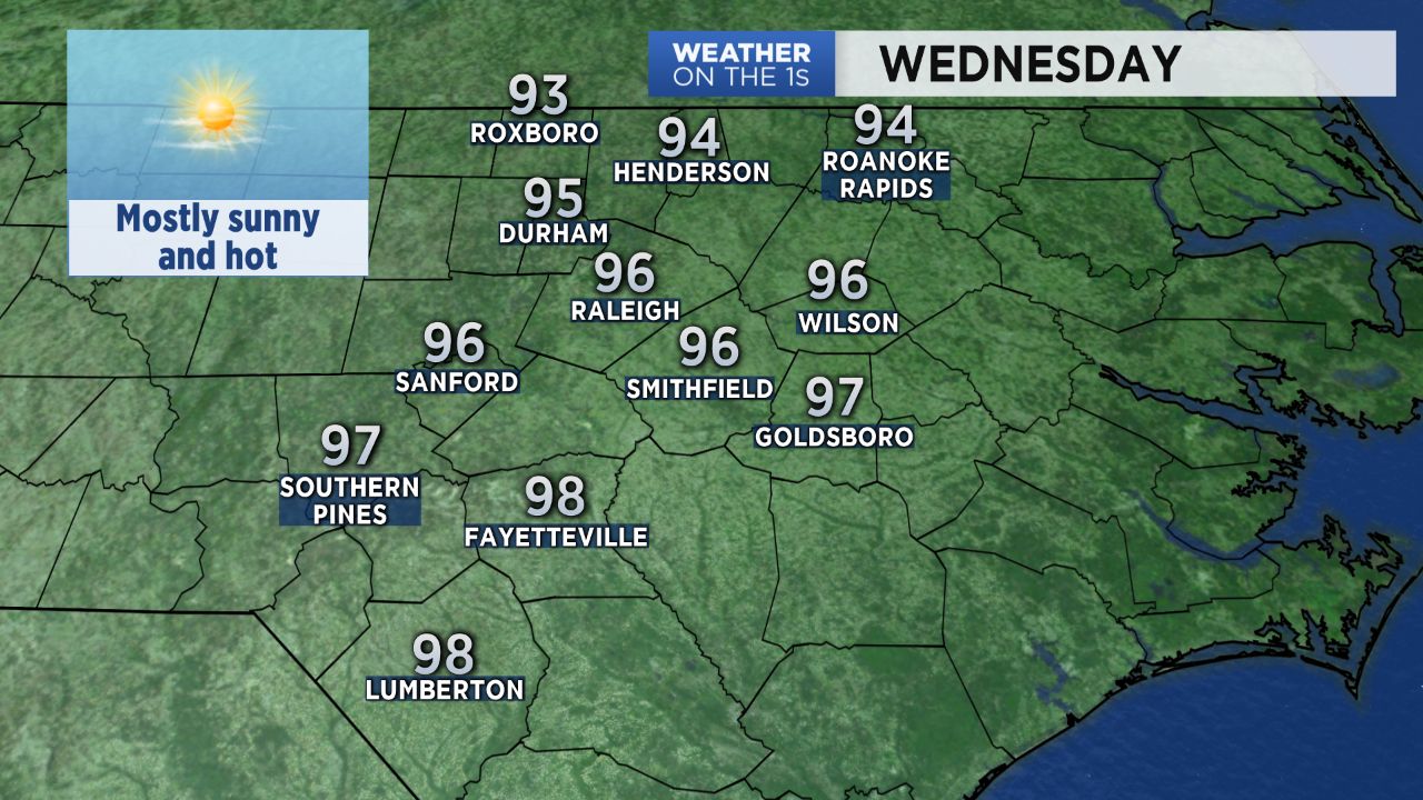
Cooler mornings to start this week almost made it feel like fall in a few spots. That will definitely not be the case Wednesday afternoon as temperatures soar to the mid and upper 90s across central North Carolina. The heat index, or feels like temperatures, will be around 100.
- 7-day forecast
- Interactive radar
- Share your weather photos with Meteorologist Lee Ringer on Facebook
Wednesday's hotter weather comes ahead of a cold front making its way toward North Carolina from the north. Most of the state should see plenty of sunshine all day ahead of that front. Thunderstorms will form ahead of that front in the afternoon across parts of Virginia.
Some of the storms over Virginia could make their way into northern North Carolina late Wednesday night. The highest chance for rain will come north and northeast of Raleigh. A few of the storms could produce locally heavy downpours and frequent lightning.
As the front slowly makes its way across the state Thursday, scattered storms are possible in the afternoon especially south of Raleigh. Otherwise, it will be a partly sunny day.
The front will bring slightly cooler temperatures for the last half of the week likely making Wednesday the hottest day of the week. Highs in the upper 80s to near 90 are forecast from Thursday into the upcoming weekend.
Get the latest news, sports and weather delivered straight to your inbox. Click here to sign up for email and text alerts.