


AUSTIN, Texas -- April ended up being much drier than normal which has put some of the area in a moderate drought.
While April didn't bring us a lot of April showers, May has a decent potential for making up for that. The 30 day outlook for May has our region with above normal precipitation for the month. We have had our fair share of cold fronts during the month of April but not much rain from these fronts because a few ingredients to produce widespread heavier rains were missing.
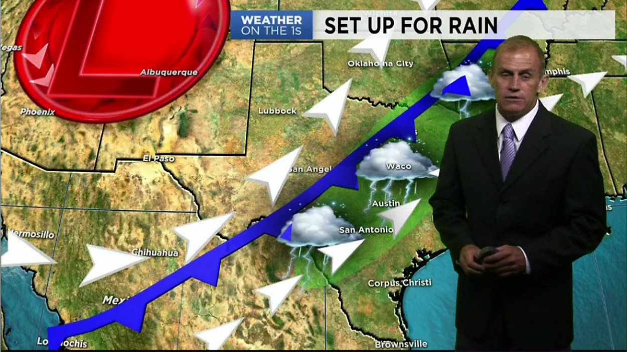
In order to get heavier rain across South Central Texas we need the upper level flow coming from the Pacific across Mexico into the Balcones Escarpment. This southwest flow sends Pacific moisture and weak upper level disturbances into our area as the cold front stalls to our west.
This sometimes can bring heavy rain and flooding. We will see this type of set up already for the later part of this week into Saturday.