


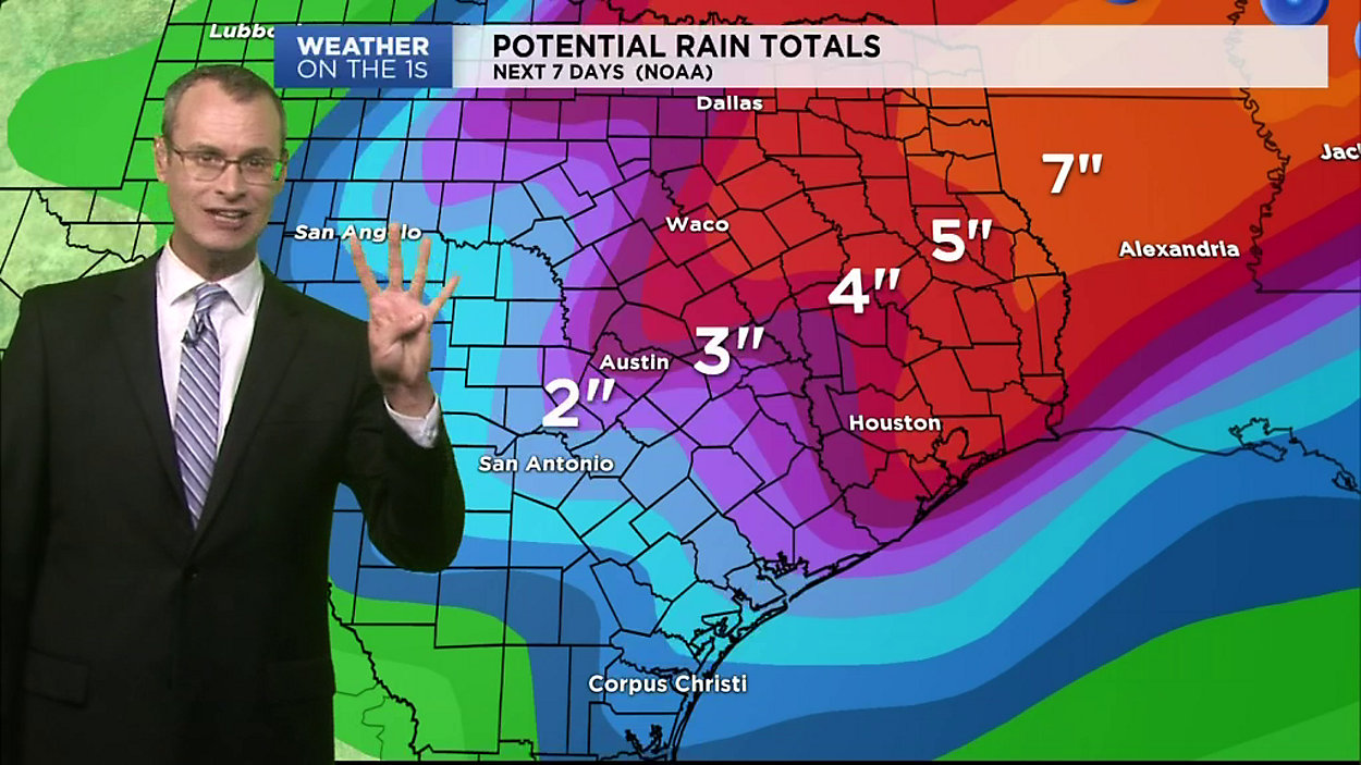

CENTRAL TEXAS - Time to dust off your umbrella: the forecast here at home looks wet through the middle of the week, with some strong thunderstorms in the mix at times.
As of Monday morning, take a look at the video above and the forecast below for what we think you can expect.
Keep in mind, computer models update frequently and the forecast might change quite a bit, so be sure to check back for the latest on the main weather homepage and, of course, with 'Weather on the 1s' on TV or the live stream.
MONDAY: Afternoon sunshine & a strong southerly breeze with a 20% chance of showers or an isolated storm (west). Storms develop along the dryline in West Texas, with impact Wichita Falls to Abilene to San Angelo.
MONDAY NIGHT: Scattered showers start to break out in parts of the Hill Country and could impact the Austin area before daybreak. 40% rain/storm chance
TUESDAY: 60% chance of showers & storms, most of the heavy rain well northwest of Austin.
TUESDAY NIGHT: 80% rain/storm chance; storms gradually build along slow-moving cold front which is drifting southeast. It'll carry the heaviest rain and potential for severe storms into the Hill Country first.
WEDNESDAY: 80% rain/storm chance; storms fire time and again along cold front as it creeps southeast. Periods of heavy downpours, lightning & thunder for Austin and Hill Country. The strongest storm cells could produce large hail and damaging winds.
WEDNESDAY NIGHT: 90% rain/storm chance; appears to be the peak of this weather episode. Heavy downpours could cause ponding of water on roadways. Front moving directly over San Antonio-Austin, running parallel to I-35.
THURSDAY AM: Showers & storms gradually move southeast.