
RALEIGH, N.C. -- We saw a typical summer-like day across the area on Saturday with dry weather but a few more showers and storms are in the forecast for Sunday.
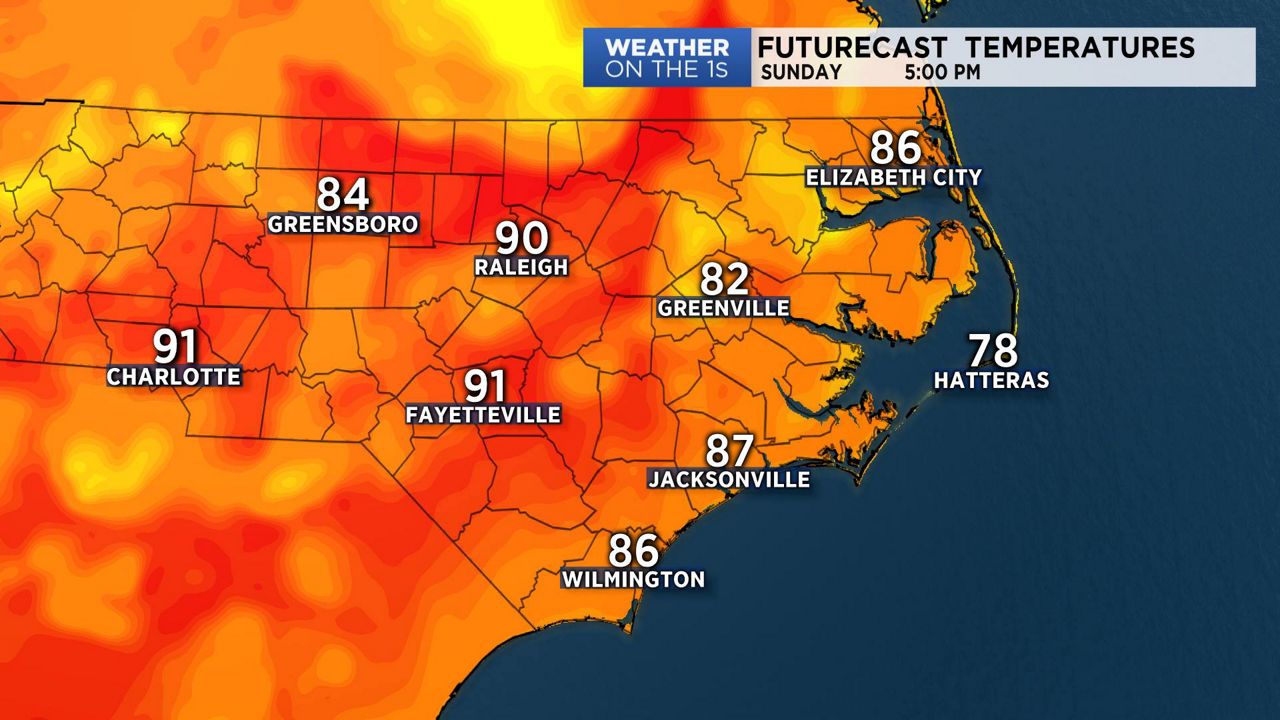
- On Sunday, we'll wrap-up the weekend with partly cloudy skies and hotter afternoon temperatures
- Slightly better chance of scattered afternoon showers and storms
- Even hotter weather is in the forecast for the start of the new week
High pressure off the North Carolina coast will keep us partly cloudy through the night into Sunday morning.
On Sunday, we'll wrap-up the weekend with partly cloudy skies and hotter afternoon temperatures.
A disturbance crossing the region with trigger a slightly better chance of scattered afternoon showers and storms. These showers and storms are expected to linger into the evening hours on Sunday.
Even hotter weather is in the forecast for the start of the new week as we should see highs well up into the 90s on both Monday and Tuesday with just a small chance for and afternoon shower or storm.
By the middle of the week, we are expecting a better chance of showers and thunderstorms, with daytime highs continuing to run above average for mid to late June.
In the tropics, the National Hurricane Center is monitoring an area of disturbed weather near the Yucatan. There is a low chance for development with this system.
Watch Spectrum News for your complete local weather forecast.
Get the latest news, sports and weather delivered straight to your inbox. Click here to sign up for email and text alerts.