


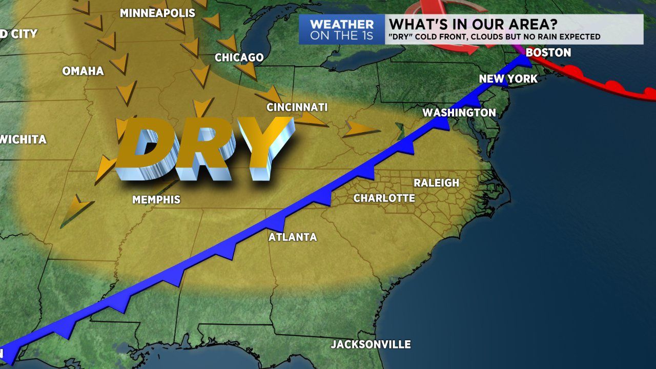
Another cool start with morning temperatures in the 30s and 40s. But unlike Monday, today will be seasonable and warm by the afternoon. The jump in temperatures is in response to an approaching cold front. Thanks to extremely dry air, no rain is expected with this frontal passage. We'll enjoy a very brief warm up to seasonable conditions in the 70s today before cold air comes in behind the front Wednesday.
Cool high pressure will build in over the Ohio River Valley and push temperatures below average beginning tomorrow. Afternoon highs will fall into the mid 60s Wednesday and the 50s Thursday and Friday.
During this time tropical moisture will filter in to the area thanks to the remnants of what is currently hurricane Willa.
Hurricane Willa currently stands as a category 4 hurricane according to the National Hurricane Center. It will make landfall along the west coast of Mexico and travel northeast over the coming days. By the end of the week the remnants of this system will likely mean numerous showers and a few storms for the Carolinas late Thursday through Sunday.