


As it edges towards the Florida Panhandle, Hurricane Michael's intensification continues. The category 2 hurricane will likely upgrade to a category 3 within the next 24 hours.
Landfall is expected to occur Wednesday afternoon near the Panama City, Florida area. At that point, Michael is forecast to have max sustained winds at 125 mph and stronger wind gusts. Storm surge at landfall is forecast to reach as high as 12 feet. That issue will go along with the concerns of flooding rains, damaging winds and tornadoes. This is a potentially devastating storm for people along the Florida panhandle, southeastern Alabama and southwest Georgia.
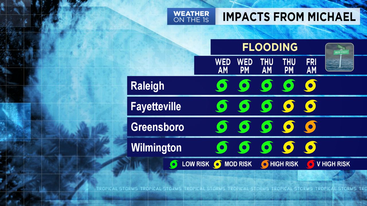
As for North Carolina impacts, the threats aren't as great but still a cause for concern. Michael will likely arrive to North Carolina Thursday as a weakening tropical storm. This means flash flooding, strong wind gusts and even tornadoes are still possible.
Expect scattered to numerous showers and storms to begin building in to the state late Wednesday. Rain coverage will broaden through the day Thursday as Michael makes it way through. Sustained winds associated with Michael will likely be around 50 mph near the center. So much of the area will deal with winds between 15 to 30 mph. Gusts however may reach as high as 50 in some locations. Given how saturated our grounds are after Hurricane Florence's rainfall, it won't take much to knock over a few weak or damaged trees. With that in mind, isolated to scattered power outages will be possible.
Unlike Florence, Michael is a fast moving storm. That means flash flooding concerns aren't as high. Instead of measuring rainfall totals in feet like with Florence, we'll be measuring them in inches with Michael. Based off the latest data, rainfall expectations fall anywhere between 2 to 5 inches. Some isolated locations may receive higher amounts.
The tornado threat Thursday into Friday morning is very low, but not zero. Tropical tornadoes usually spin-up quickly and are short-lived. Do not let the tropical storm title fool you in to thinking the threats aren't real. Remember we had more tornado warnings in our area when Florence was a tropical storm compared to when it was a hurricane.
The good news is after Michael tracks northeast from over the Carolinas Friday, our weather will quickly improve. Behind Michael, a cold front will sweep across the state ushering in much cooler and drier air. Sun will dominate our Saturday and Sunday as temperatures fall into the 70s for an afternoon high each day.