


The last thing much of North Carolina needs right now is more rain. Unfortunately, a front approaching the state from the west will bring the chance for rain to the region starting Wednesday. The chance for rain will then continue through the end of this week.
- Interactive radar
- 7-day forecast
- Share your weather photos with Meteorologist Lee Ringer on Facebook
The first round of showers and storms from the front may not arrive in central North Carolina until late Wednesday afternoon or even Wednesday night. Look for partly sunny conditions for much of the day with highs warming to the mid 80s in the Triangle and the upper 80s in the Sandhills.
Off and on rain is then expected through the night and for much of Thursday. The showers should keep temperatures in the 70s all day around the Triangle. Highs will warm to the at least the low 80s in the Sandhills where a few strong storms could develop.
Lingering showers along the slow moving front will still be possible Friday. All of the rain should come to an end by Friday night.
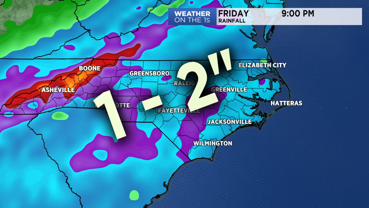
Much of the state should see around one to two inches of rain from late Wednesday through Friday night. Since that amount of rain will be spread out over a few days, it should reduce the threat for flash flooding.
Sunshine and dry weather conditions are forecast to return for the upcoming weekend.