


A cold front approaching North Carolina from the north will bring just slightly cooler afternoon temperatures by this upcoming weekend. It will also bring a higher chance for showers and storms for the weekend.
- 7-day forecast
- Interactive radar
- Share your weather photos with Meteorologist Lee Ringer on Facebook
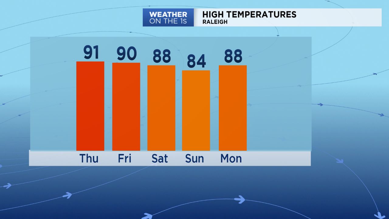
We will definitely not feel any of that cooler air Thursday or Friday though. High temperatures both days will return to near 90 and the low 90s across central North Carolina. Like most days this week, the humidity will make it feel more like the upper 90s to near 100.
Saturday will still be quite warm too with highs ranging from the upper 80s in the Triangle to the low 90s in the Sandhills. The first half of Saturday should be dry, and then rain chances will increase toward the end of the day as the front moves into the state from the north.

The chance for severe storms appears low as this time. However, some of the storms that are expected from late Saturday afternoon into Saturday night could produce locally heavy downpours and frequent lightning.
It now appears that the front will stall over the Carolinas for the second half of the weekend. That will keep the chance for showers and storms around for Sunday when high temperatures may only reach the mid 80s.
The front will eventually moves back to the north as a warm front. That should bring afternoon highs back to near 90 for at least a few days next week.
Get the latest news, sports and weather delivered straight to your inbox. Click here to sign up for email and text alerts.