


Our Sunday began with a fair amount of sunshine. But steadily through the day clouds have built in overhead and storms are blossoming on radar. Despite an increasingly cloudy sky, temperatures will be quite warm for an afternoon high in the mid to upper 80s for many. Southerly winds are also ensuring there’s more than enough moisture for the storms we’re due to see later today.
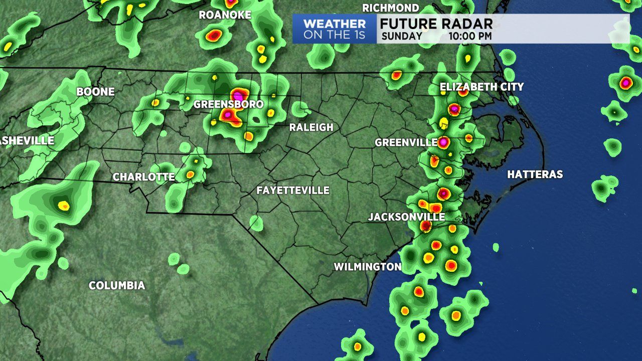
Storms will continue to flare up across eastern North Carolina as we move through a warm and muggy Sunday afternoon and evening. The Storm Predication Center did place much of eastern N.C. under a marginal (low) severe weather risk. We’ll likely deal with thunderstorms producing localized heavy rain, frequent lightning and gusty winds through the remainder of the day and well into the night. On a few occasions we may have an isolated intense or severe storm capable of producing damaging wind gusts and hail. So remain weather aware.
We’ll likely continue to deal with storms in the area through the overnight hours as temperatures remain mild in the mid 70s. Cloudy skies will hold steady as we get into the new workweek. With rain still in the area early Monday morning, take your time during a wet morning commute.
Over the next 5 to 7 days rain remains a likely possibility as an upper level low hovers to our northwest over the Ohio River Valley. The low will steer several disturbances through the state ensuring a soggy forecast for the next week. Some location could receive between 1 to 3 inches of rain over the next 48 hours alone.