


After a morning with pre-dawn showers and storms, our day has been pretty calm across central North Carolina. That changes as we move through the late afternoon and evening hour. As an upper level low continues to slowly turn over the Ohio River Valley, we continue to receive round after round of disturbances moving through.
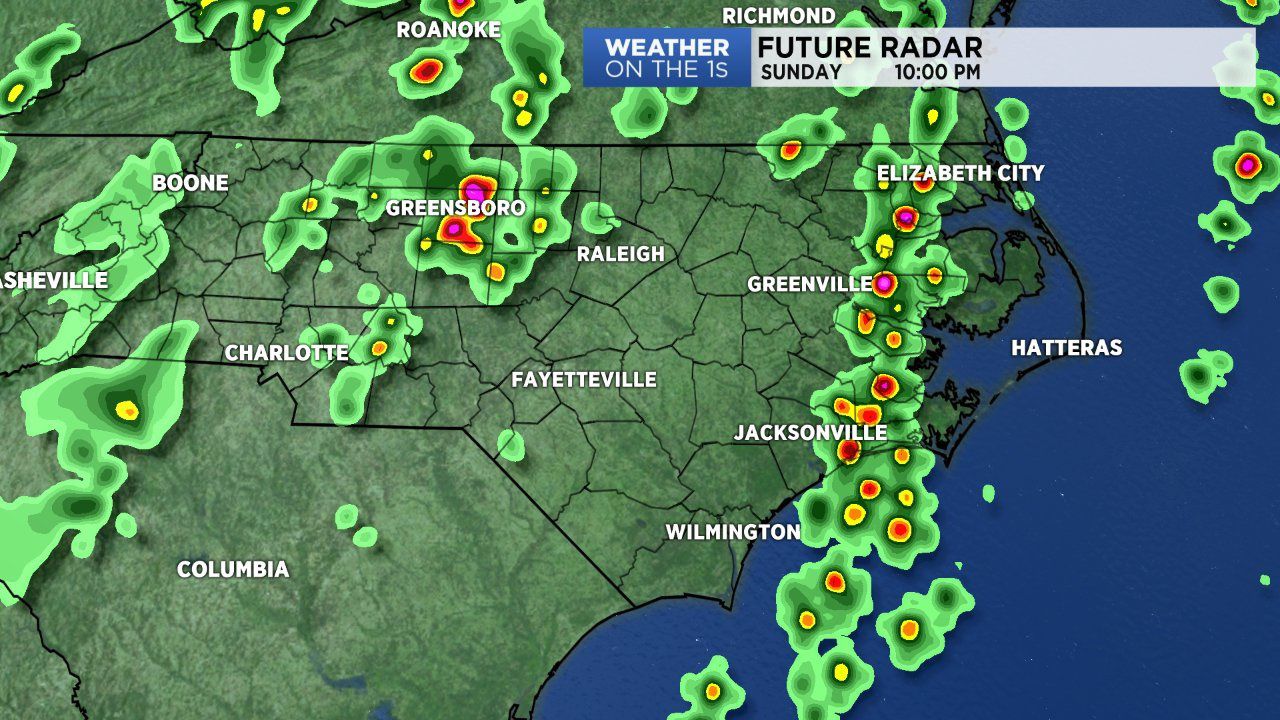
We’ll likely move through the back-half of our Sunday with isolated to scattered storms. The Storm Prediction Center places much of central and eastern N.C. under a marginal (low-end) risk for strong to severe storms.
So expect highs this afternoon peaking in the mid to upper 80s with rain storms passing through. A few storms may hang on late into the night. During this time much of eastern N.C., especially coastal areas will deal with a wider coverage of storms well into the night.
The upcoming workweek is looking soggy. Each day has a high rain chance. Monday and Tuesday look to feature cloudy skies with showers and storms beginning early in the morning and lasting through the entire day. It’s possible some locations could receive anywhere between 1 to 3 inches of rainfall over the next 2 to 3 days.