


Thursday will be the last day for a while with no rain in the forecast. All of central North Carolina will enjoy mostly sunny skies and somewhat lower than normal humidity for July. High temperatures will top out in the upper 80s for the Triangle to near 90 in the Sandhills.
- 7-day forecast
- Interactive radar
- Share your weather photos with Meteorologist Lee Ringer on Facebook
A front that has briefly stalled to our south over southern South Carolina will move back to the north as a warm front starting Friday. That will bring higher humidity to the region by the weekend along with increasing chances for afternoon and evening storms.
The chance for storms Friday will be highest across southeastern North Carolina, but a few storms could make their way into portions of central North Carolina by late afternoon.
Scattered storms will be more likely Saturday and Sunday afternoons. Some could produce heavy downpours, frequent lightning, and gusty winds.
This weekend will just be the start of an unsettled weather pattern that will keep scattered afternoon storms in the forecast each day through next week.
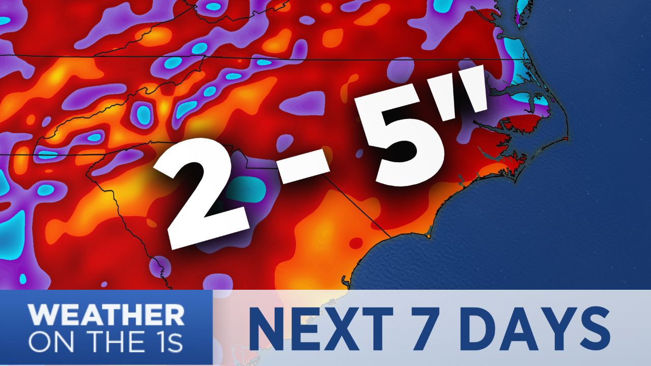
Computer model forecasts indicate much of the area will see around two to five inches of rain from this weekend through next week.
Long range forecasts suggest the wet weather pattern may then continue into the following week.