


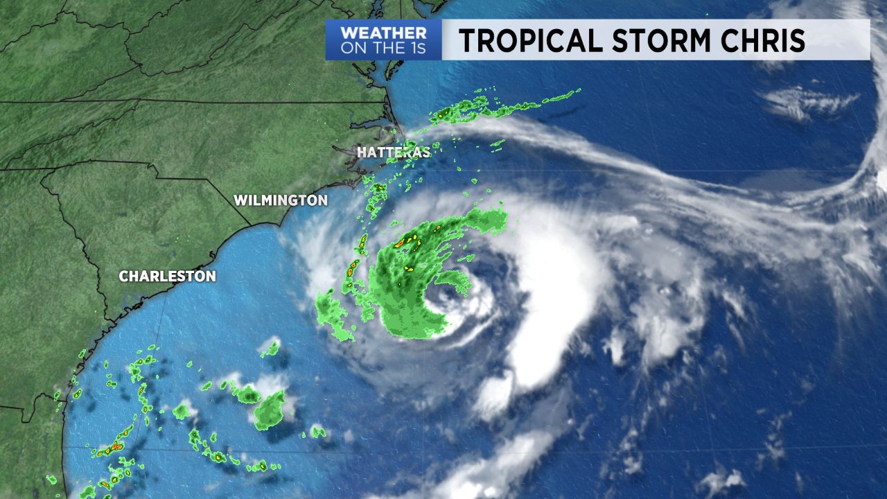
When you walk outside Monday almost anywhere in North Carolina, you would never know a tropical storm is sitting about 200 miles off the state's coast. Tropical Storm Chris is just far enough off the coast that it will continue to have very little to no impact in the weather across the state. Just a few isolated showers are possible at the Outer Banks Monday.
- Tropical Storm Chris brings rip current dangers.
- Chris should become a hurricane late Monday or early Tuesday.
- Isolated showers possible on the Outer Banks.
The biggest concern Chris brings to North Carolina is the danger for rip currents at our beaches. Swimming is strongly discouraged Monday at most of the state's beaches as these powerful channels of water can pull even experienced swimmers away from shore.
Tropical Storm Chris will remain nearly stationary over the warm waters off the North Carolina coast Monday. That will allow it to strengthen. The storm is forecast to become a category 1 hurricane by late Monday or Tuesday.
Chris should begin to move slowly to the north or northeast Tuesday. As a cold front approaches the state, it will pick up speed to the northeast Wednesday taking it away from the Carolina coast.
That front will also bring the chance for scattered thunderstorms to the region for Wednesday afternoon.
The remnants of what was once Hurricane Beryl may track just off the Carolina coast around the middle to second half of the week. That could keep the danger for rip currents at our beaches for most of the week.
Get the latest news, sports and weather delivered straight to your inbox. Click here to sign up for email and text alerts.