


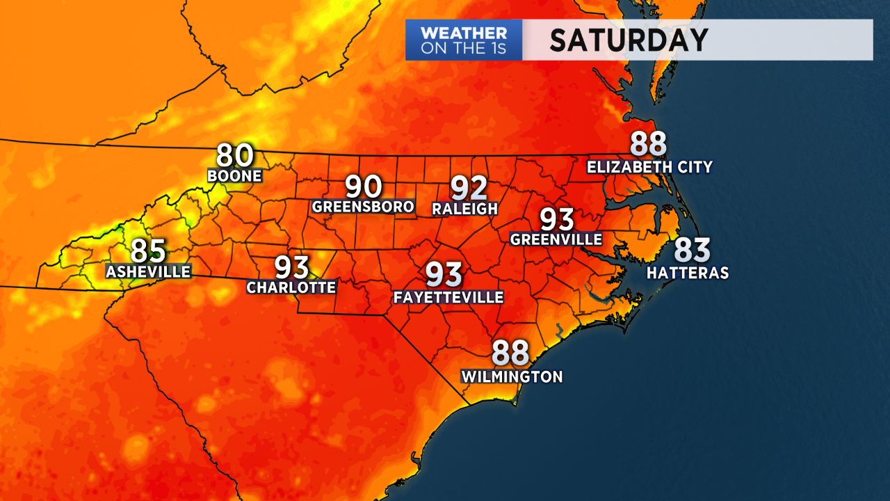
High temperatures will soar to near 90 and the low 90s over most of North Carolina Saturday afternoon. The hot weather will cause our air to become stagnant trapping in pollution like ground level ozone.
The North Carolina Division of Air Quality has issued a Code Orange Action Day for Saturday for areas around the state's largest cities including Charlotte, Greensboro, and Raleigh. Code Orange air quality means the levels of pollution could be unhealthy for sensitive groups including anyone that suffers from respiratory problems like asthma. Anyone with respiratory illnesses is strongly encouraged to limit their time spent outside Saturday especially during the hottest part of the afternoon.
An outdoor burning ban is also issued anytime there is a Code Orange alert as burning can release toxic chemicals into the air.
We can all do our part to help improve the air quality by driving less on poor air quality days. If you need to fill your vehicle with gas, wait until a cooler part of the evening or the next morning.
An air quality alert is not in effect for the mountains or along the coast. Temperatures in these locations should warm to the 80s Saturday. Along the coast, the sea breeze often limits any concerns about poor air quality.
Sunday's forecast will be just as hot as Saturday across the state.
There's a 20% chance or less for any isolated afternoon storms through the weekend. Showers and storms will likely be more widespread across the region starting around Tuesday and Wednesday of next week. That should help to create improved air quality across North Carolina.