


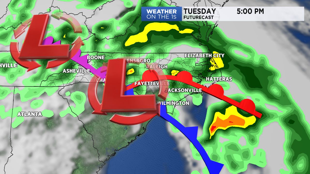
Rain will continue to fall off and on for most of the day Tuesday. Low pressure moving across the Carolinas will also make for a windy day. Gusts up to 35mph will be possible at times.
The wind gusts combined with a wet ground could be enough to topple a few trees in the region leading to spotty power outages.
A few thunderstorms are possible along with Tuesday's rain. There is a small chance a storm or two could become strong with damaging wind gusts.
A warm front across the region will bring afternoon temperatures into the 70s for areas south and east of Raleigh. Highs in the mid to upper 60s are forecast for the Triangle and locations to the north.
Much of the rain will taper off to just spotty showers this evening.
Most of Wednesday morning will be dry, but scattered showers are possible Wednesday afternoon.
Rainfall totals from the first half of this week should range between one and two inches for much of central North Carolina. Somewhat higher totals are possible in southeastern North Carolina.
Get the latest news, sports and weather delivered straight to your inbox. Click here to sign up for email and text alerts.