


Track showers and storms across North Carolina with our interactive radar
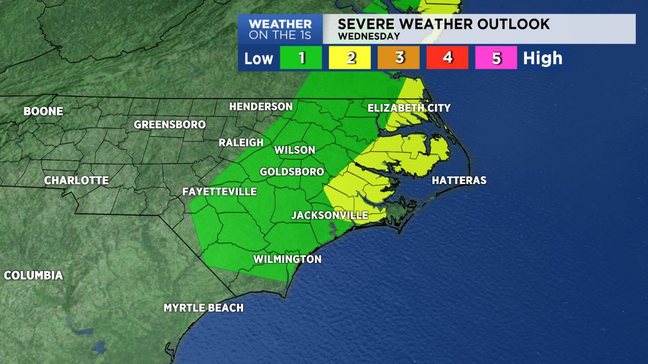
The Storm Prediction Center has placed parts of eastern North Carolina in a "marginal" to "slight" risk for severe storms Wednesday. Those are the two lowest levels of a five level severe weather risk scale. This means a widespread outbreak is not likely, but a few storms could still become a bit intense.
An area of rain that moved over the mountains of western North Carolina fell apart early Wednesday morning. However, a broken line of showers and thunderstorms expected to re-develop into the afternoon. The highest chance for storms will come east of I-95 and near the coast.
Any severe storms would be isolated in nature, so many locations will not experience one. However, the strongest storms that form will be capable of producing brief downpours, lightning, and damaging wind gusts.
It will be breezy through the day even outside of any storms with gusts up to 30mph. Wind gusts inside of the strongest storms could be over 50mph.
The storms will move off the coast by late afternoon and early evening. Much cooler air will move into the state through Wednesday night. Lows will drop to the 30s in much of the North Carolina by sunrise Thursday morning.
Stay tuned to Weather on the 1s for updates.
Get the latest news, sports and weather delivered straight to your inbox. Click here to sign up for email and text alerts.