


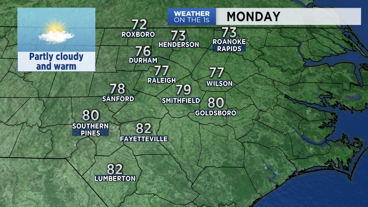
The pleasant weather from the Easter weekend continues Monday! Most locations will even be a little warmer Monday afternoon. Highs will range from the mid and upper 70s across the Triangle to the low 80s in the Sandhills.
Similar temperatures are forecast for Tuesday when we'll see another partly cloudy day.
Our next chance for rain will come Wednesday as a front moves through the state. Watch for showers and a few thunderstorms around late morning to early afternoon.
The Storm Prediction Center says there's a "marginal risk" for a few severe storms capable of producing damaging wind gusts in North Carolina during that time. A marginal risk is the lowest level of the Storm Prediction Center's five level risk scale.
Get the latest news, sports and weather delivered straight to your inbox. Click here to sign up for email and text alerts.