


We started the week with unsettled weather and that pattern will continue into Wednesday.
As a matter of fact, the first full day of Spring 2018 may come with the chance for a few snowflakes for some!
As low pressure moves north and east away from North Carolina tonight, another system will move into the state. We'll see a chance for showers through the overnight hours.
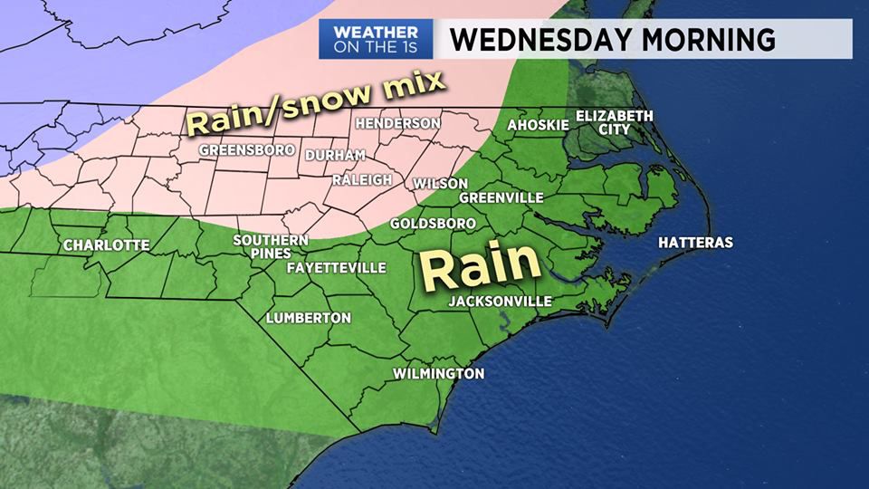
By Wednesday morning, colder air will drop into the region. With the precipitation and colder air, there is a chance that we may see a little rain/snow mix during the first half of Wednesday. The best chance to see this wintry mix, will be from the Triangle northward. With ground temperatures in the 40s (well above freezing) and limited wintry precipitation, it looks like any chance for accumulation would be limited. Areas from I-85 north look to have the best chance for seeing a light accumulation of snow on grassy and elevated surfaces. We should see any frozen precipitation change back to all liquid precipitation by midday on Wednesday.
Skies will clear Wednesday night as high pressure builds into the area. This high will control our weather through the end of the week.
Watch Spectrum News for your latest local forecast.