


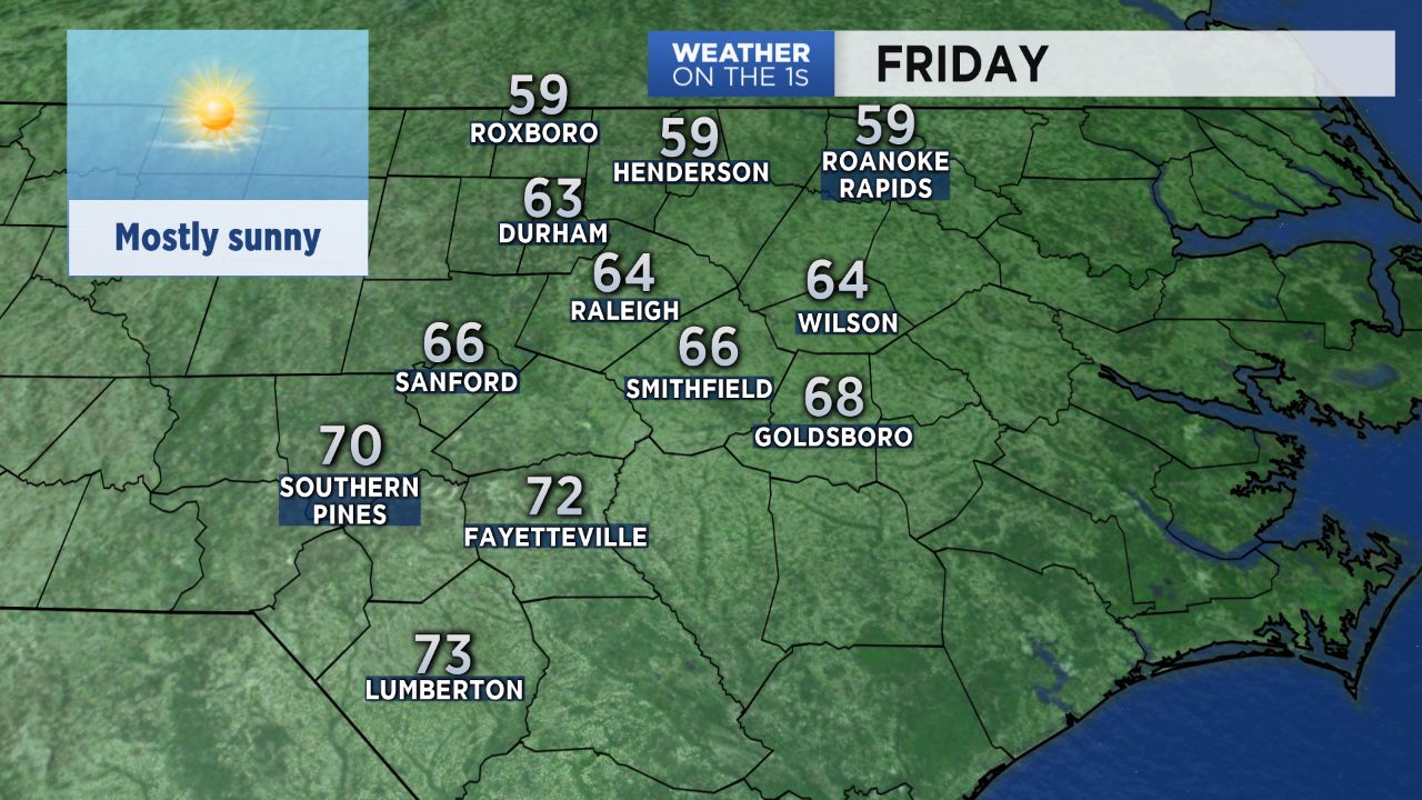
Our forecast is looking nice to wrap up the work week! We'll see plenty of sunshine all day Friday.
A weak front moving through the state will cause a range in temperatures around the region. Highs north of the Triangle and near the Virginia border may only warm to the upper 50s. The low and mid 60s are expected across the Triangle. Locations near Fayettevile in the Sandhills could reach the low 70s.
While we enjoy the sunny weather Friday, we will also watch a developing area of low pressure to our west. That system will eventually bring a few showers to North Carolina this weekend.
Fortunately, we should have a little luck for Saint Patrick's Day Saturday, and it will not be a washout. Saturday morning will be dry with increasing cloudiness. Then look for just spotty showers in the area during the afternoon. A second wave of showers could pass through central North Carolina late Saturday night. Saturday's highs will top out in the 60s.
Rainfall totals Saturday through Saturday night should be less than half of inch around the state. Many locations may even end up with less than a quarter of an inch.
Most of the day Sunday will be dry with highs in the mid to upper 50s.
Rain will likely return during the first half of next week.