


We may be inching closer to spring but it looks like winter is not through with North Carolina just yet. An early week system looks to bring a few snowflakes and a few sleet pellets to parts of the area.
A developing area of low pressure off the North Carolina coast will pull moisture back across the region through the overnight and into Monday. The chance of showers will continue through the night and continue into Monday morning.
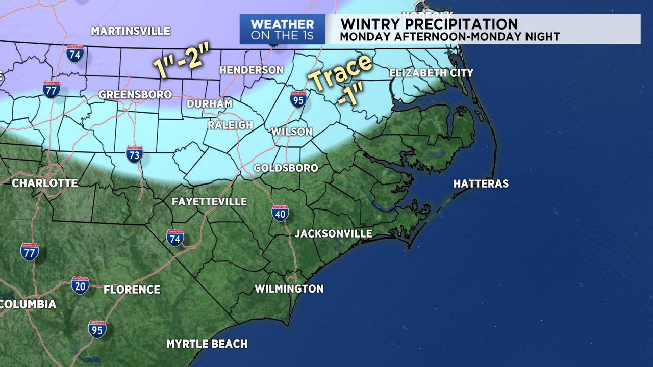
As colder air moves into the state during the day on Monday, we will see a transition to sleet and then to snow on Monday afternoon and evening. Precipitation will taper off by Monday night.
With ground temperatures above freezing, this should limit chances for accumulations of snow and sleet. However, areas that see a quick burst of wintry precipitation could see a quick accumulation. Grassy areas and elevated surfaces are the most likely areas to see accumulations. A few slick spots may occur on area roads, mainly on bridges and overpasses.
For the most part, this should be a low impact event for most of central North Carolina. However, this forecast needs to be monitored for any changes tonight and Monday.
Skies will clear and we'll see more sunshine on Tuesday.
Watch Spectrum News for your latest local forecast.
Get the latest news, sports and weather delivered straight to your inbox. Click here to sign up for email and text alerts.