


Saturday definitely the day for outdoor activities this weekend, just a few spotty light showers will be possible Saturday morning. As we get through Sunday rain will become more and more likely.
A developing low pressure system to our west will keep most of the rain away from us for the first half of the weekend expect for the chance of a few spotty showers Saturday morning. Saturday is looking to be mostly cloudy with highs in the upper 50s in the Triangle to the low 60s in the Sandhills.
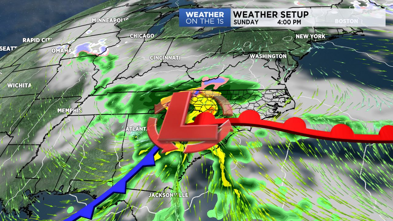
As that low pressure system tracks toward the Carolinas, the chance of rain increases from late Saturday night into Sunday morning. The highest chance for rain will then come Sunday afternoon when the rain could be heavy at times. It will be a chilly rain with highs only in the upper 40s in the Triangle to the 50s south and southeast of Raleigh.
Rainfall totals from Sunday through early Monday morning should range between a half inch to an inch and a half.
Beyond Sunday afternoon, the track of this storm system still remains uncertain. The track will ultimately determine if any precipitation lingers across North Carolina into Monday morning.
Some computer model forecasts, but not all, have indicated cold air wrapping in behind the low early Monday morning, could change the rain to a mix of rain and snow or all snow for locations near or north of the Triangle.
Stay tuned to Weather on the 1s on Spectrum News as we continue to update the forecast through the weekend.