


What an impressive, over-achieving winter storm that was!
As we approached the event, it became increasingly evident that the upper level energy responsible for the storm was going to be stronger than originally anticipated, and therefore, the snow would be heavier and last longer than it otherwise would have.
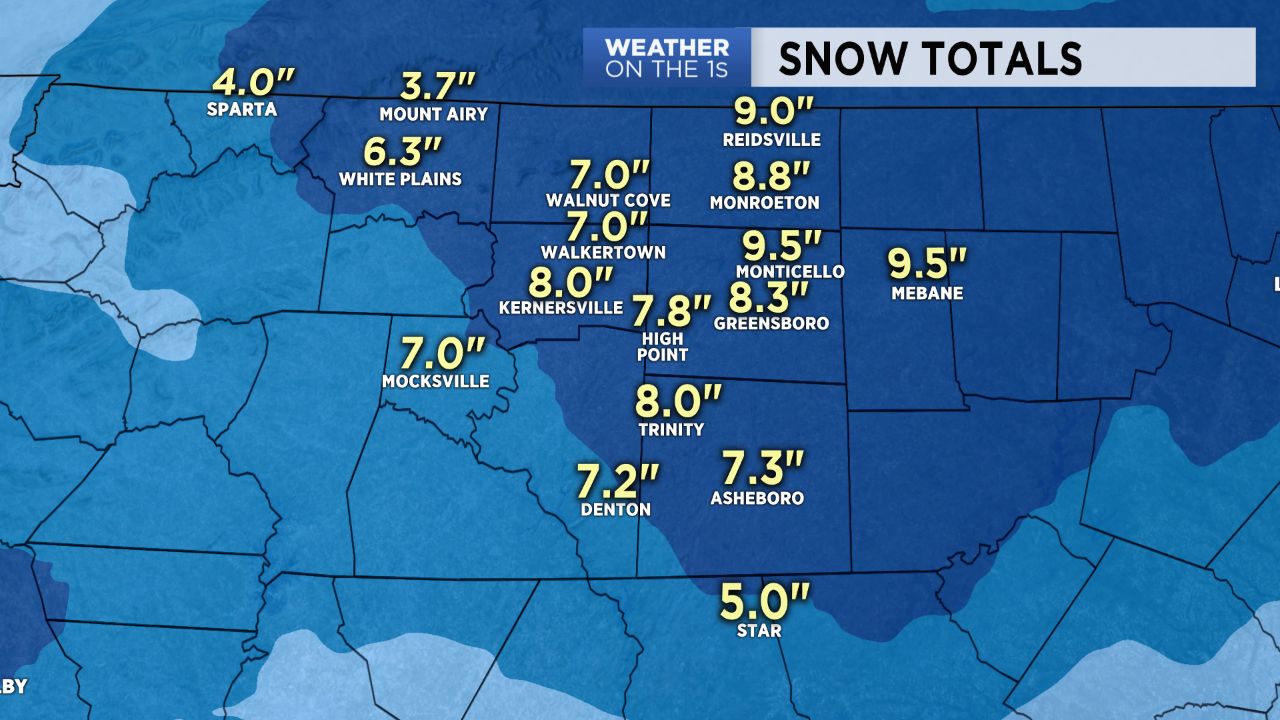
The result? Widespread snow totals in the 5-9"+ range in the Triad viewing area, and some bullseyes close to one foot just to our east over toward Orange County.
Arctic air remains in place today, and highs will likely struggle to make the mid to upper 30s. Any melting that occurs today that does not evaporate will quickly refreeze this evening and tonight with lows heading down into the teens to lower 20s by Friday morning.
Highs should approach the lower 50s tomorrow, and then I expect mid and upper 50s over the weekend as we thaw things out.
Get the latest news, sports and weather delivered straight to your inbox. Click here to sign up for email and text alerts.