


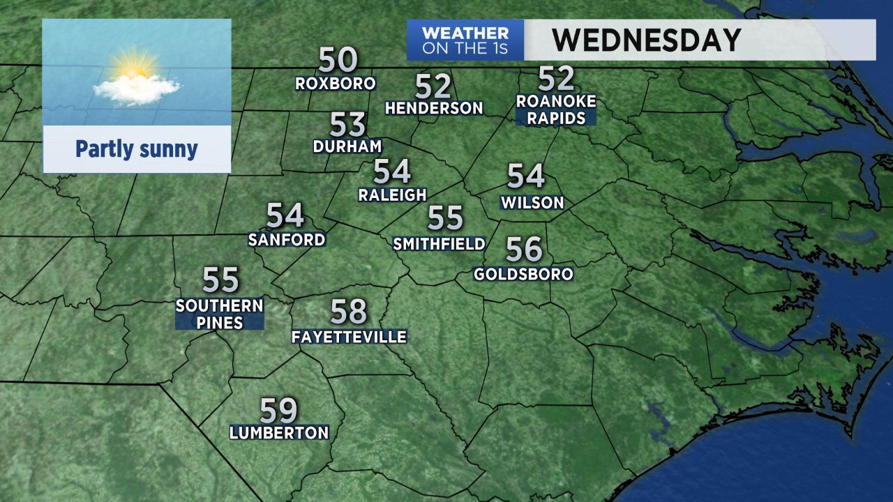
Temperatures soared into the 60s Tuesday afternoon over much of central North Carolina. Wednesday likely will not be quite as warm, but highs should still be a bit above average.
Afternoon temperatures will range from the mid 50s around the Triangle to the upper 50s in the Sandhills. The normal high at this point in January is around 50.
The rest of this week will be warmer and a bit wetter. Highs in the low to mid 60s are forecast for Thursday. Friday will warm to the upper 60s to near 70.
Much of Thursday will be mostly cloudy with showers arriving in the region by late afternoon and evening. Off and on showers may then continue into Friday. A last round of showers and even a few thunderstorms with strong wind gusts will be possible late Friday afternoon and evening.
Much of central North Carolina should see around a half-inch to inch-and-a-half of rain from late Thursday through Friday night. That rain should completely come to an end by early Saturday morning.
The weekend forecast is for dry weather and colder temperatures. Saturday will be in the 50s much of the day. Temperatures will then drop to near 30 late Saturday night and early Sunday morning. Despite a sunny day, Sunday's temperatures will only warm to the low 40s.