


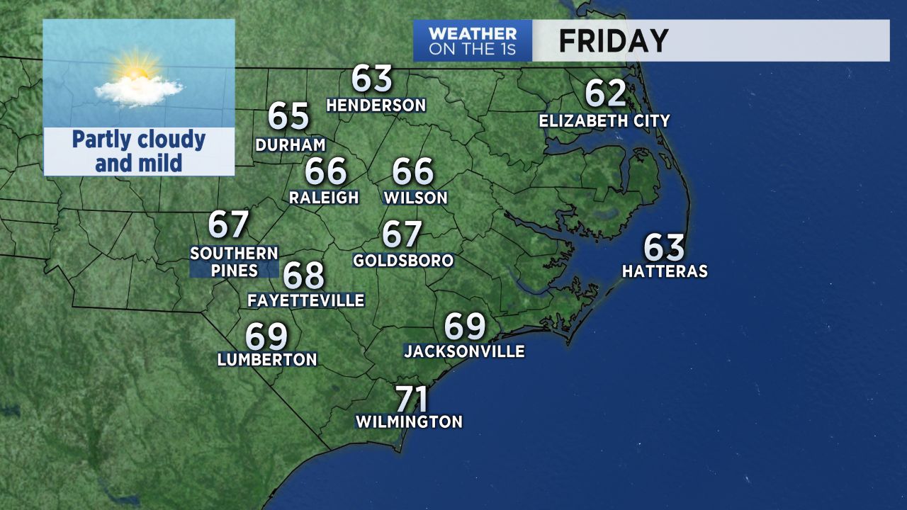
December is off to a mild start across central North Carolina. Friday's high temperatures will warm to the mid 60s in the Triangle and the upper 60s across the Sandhills. We'll see a mix of sun and clouds through the day.
There are a few changes in the forecast for Saturday. We'll see a lot more clouds and a 30 percent chance for spotty light showers through the day. That will keep us cooler. Temperatures will range from the low and mid 40s early in the morning to just the low and mid 50s in the afternoon.
Look for more sun breaking through the clouds Sunday. Highs will warm to the low and mid 60s Sunday afternoon.
A warming trend will continue for the first couple days of next week. Highs in the upper 60s to near 70 are likely by Tuesday.
Our next good chance for rain will come Wednesday as a strong cold front moves through the state. Early model forecasts suggest around an inch to an inch and a half is possible with the front.
Much colder air will arrive behind the front late next week. Highs on Thursday and Friday may only top out in the 40s. Colder than average temperatures will likely continue through at least the middle of December.
Share your weather photos with Meteorologist Lee Ringer on Facebook and Twitter. Your photo could be featured on Spectrum News or here at spectrumlocalnews.com!