


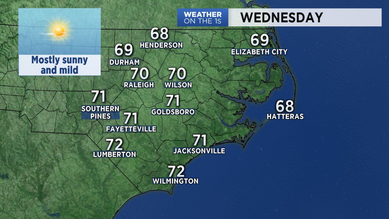
If you enjoyed the sunny and mild afternoons so far this week, you have to love Wednesday's forecast. It will be just as nice as the last couple of days, only warmer. Mostly sunny skies through the day will allow highs to top out around 70 across central North Carolina. A few spots in the Sandhills could even see the low 70s.
While it will not get much cooler through the end of the week, Wednesday will be the warmest afternoon of the week. Highs in the mid 60s are forecast for Thursday and Friday with morning lows in the 40s.
If you are looking for rain, you probably do not like the forecast as much. The only rain chance for the rest of this week will come early Friday morning. Just a few spotty showers are possible between 4 and 8am Friday morning as a front passes through the region.
At one point, it appeared we would have a higher chance for showers on Saturday. However, the latest computer model forecasts now show that chance for rain has vanished. Our weekend forecast is now for dry weather.
The next good chance for rain may not come until around the middle of next week. At that point, a strong cold front could bring showers from late Tuesday night into next Wednesday morning. That front could also bring some of the coldest air so far this season to North Carolina around the end of next week.
Send your weather photos to Meteorologist Lee Ringer on Facebook and Twitter. Your photos could be featured on Spectrum News or right here on spectrumlocalnews.com.