


Sit tight, as the temperature roller coaster continues. We're starting the workweek above average with highs in the 80s yesterday, and 70s and 80s today. But a noticeable drop in temperatures is on the way. By Thursday and Friday, highs will be limited to the upper 50s to mid 60s. That's a 20-degree difference compared to the start of this week, so get ready.
Until then we'll deal with mild temperatures and some unsettled weather.
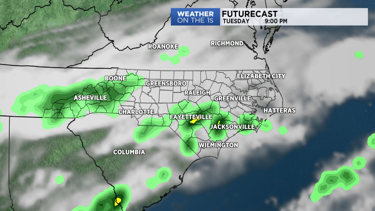
A nearly stationary front is sliding across the Carolinas today and tonight we'll likely have scattered storms blossoming along the boundary. The Storm Prediction Center has placed much of southeastern North Carolina under a marginal (low) chance for severe storms. This low risk area includes Fayetteville and the Sandhills area. Storm activity is expected to ramp up after 7 p.m. and last through the overnight hours as activity tracks east across the state. If any strong or severe storms do develop the main concern will be strong to damaging wind gusts. Rain and storm coverage will be scattered in coverage and activity will likely end for most of central North Carolina before midnight.
Wednesday will start off cloudy with a few light showers overall. With with the cold front tracking away from the state, skies will clear through the day. By Wednesday afternoon expect mostly sunny skies and highs in the low to mid 70s.
High pressure builds in late Wednesday and through the day Thursday ushering in cooler, drier air. Thursday will be a bright and beautiful day but noticeably cooler in the lower 60s for an afternoon high.
Another cold front is on the way for the weekend. Timing on its arrival is still coming together but odds look favorable for a few showers and storms late Friday and through the day Saturday. Clear will quickly take place Sunday as temperatures plunge again. Low could drop down to the 40s and 30s Sunday night into Monday morning.