


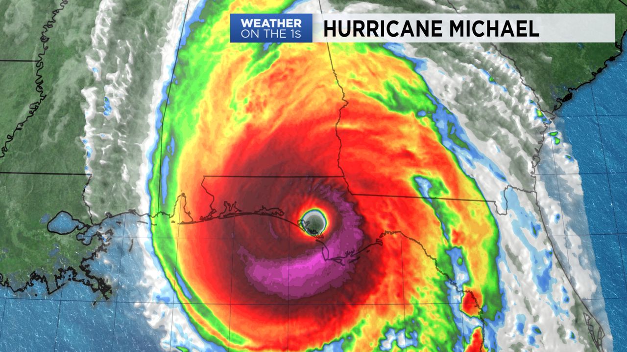
NORTH CAROLINA -- Hurricane Michael made landfall Wednesday afternoon near Mexico Beach, Florida as a category 4 storm with sustained winds near 155 mph.
- The storm will weaken as it moves over Georgia, then South Carolina Wednesday night and Thursday
- Michael will likely move over central North Carolina as a tropical storm Thursday afternoon and evening
- Much of North Carolina will likely see between three and seven inches of rain from Wednesday through early Friday
Michael is the first category 4 storm to make landfall in the United States during the month of October since Hurricane Hazel hit North Carolina in 1954.
The storm will weaken as it moves over Georgia, then South Carolina Wednesday night and Thursday. Michael will likely move over central North Carolina as a tropical storm Thursday afternoon and evening.
A steady and heavy rain is expected to over expected Thursday especially from late morning through the evening. All of the rain in the state should come to an end by either late Thursday night or early Friday morning as the storm accelerates to the northeast.
Much of North Carolina will likely see between three and seven inches of rain from Wednesday through early Friday. Somewhat lower totals around one to three inches are forecast for the immediate coast.
Wind gusts between 30 and 50 mph will be possible Thursday. With a saturated ground, the gusts could topple some trees causing spotty power outages.
Isolated tornadoes could also spin up Thursday as Michael tracks across North Carolina. The greatest threat for tornadoes is expected near and east of I-95.
Get the latest news, sports and weather delivered straight to your inbox. Click here to sign up for email and text alerts.