


Talk about being stuck between a rock and a hard place. Our weather looks to be quite active over the next 5 days.
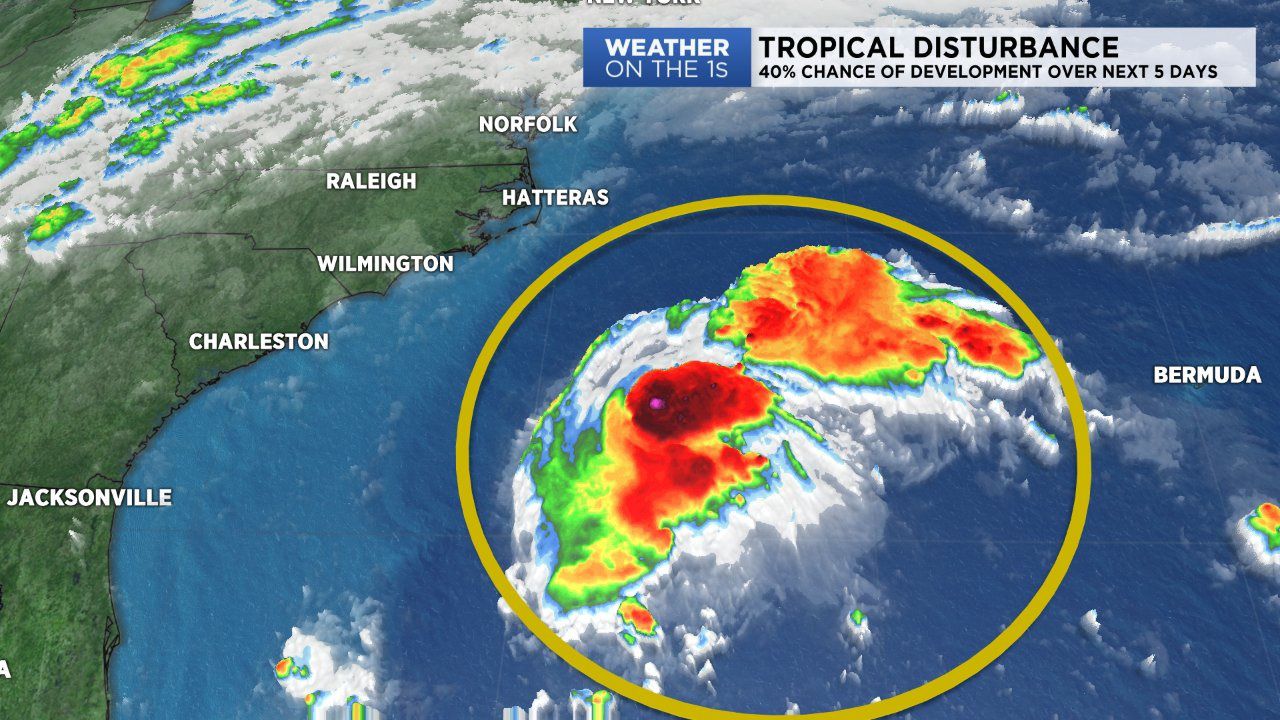
To our southeast we're monitoring a broad area of low pressure. The National Hurricane Center is giving it a 30% chance of development over the next 48 hours, and 40% over the next 5 days. Model trends has the low tracking northwest a brushing the Carolina coastline Tuesday into Wednesday.
To our west, an extensive cold front is marching towards the Carolinas and looks to sweep through later in the workweek. Tracking west to east, it looks to bring widespread rain an a few intense storms to the area Wednesday through Friday.
Thankfully the weather for our Monday night and Tuesday aren't as impactful. Clouds will continue to dominate our skies tonight as lows fall into the mid to upper 60s.
Tuesday will have a slightly higher rain chance as the broad area of low pressure tracks just offshore of the Carolinas. Showers Tuesday will track east to west across the state. Some rain may be heavy at times so make sure you have an umbrella close by. The bulk of the rain associated with this tropical disturbance will be over the coast.
Scattered showers and storms will be an issue Wednesday through Friday as a cold front slowly sweeps across the state. A warm, southerly wind will ignite ahead of the front pushing afternoon high temperatures into the mid to upper 80s Wednesday. Rainfall amounts associated with this cold front range between a quarter to an inch.
A few showers could spill over into Saturday but overall our weather looks to improve through the weekend. By Sunday we'll enjoy mostly sunny skies with highs in the low 80s.