


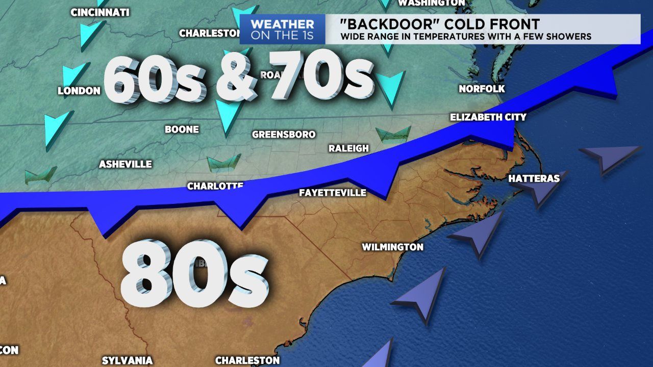
NORTH CAROLINA -- Happy first full day of Fall! The new season starts off with a pretty tricky forecast due to a back-door cold front arriving and a cold air damming situation developing. This will cause some locations across the Piedmont and Triangle to not make it out of the 70s today.
The front will slowly move south, mostly over the western half of the state through the afternoon. The front is forecast to reach the North Carolina-South Carolina line by the evening. If this holds true, areas along and north of I-40 will likely not make it out of the 70s Sunday afternoon. Areas south of that line, like Fayettville and the Sandhills areas will likely climb to afternoon highs in the mid 80s.
- Highs for Greensboro and Triad area will likely reach the upper 60s to low 70s
- Highs for Raleigh and the Triangle will climb into the mid to upper 70s
- Highs for Fayetteville and the Sanhills will be the warmest in the mid 80s
So yes, overall still a mild day across the board but its not everyday you have a 10 to 15 degree temperature range across your area.
The front will likely produce a few showers that will mostly develop along the boundary layer. We'll place rain coverage at isolated to scattered at best. Severe weather is not a concern based off of limited instability.
Temperatures will gradually warm up through the upcoming workweek as we await another, and stronger cold front. This front has the potential to produce some stronger thunderstorms for central and western portions of the state Wednesday and Thursday. These will be days to watch as we monitor the potential for severe thunderstorms.
Get the latest news, sports and weather delivered straight to your inbox. Click here to sign up for email and text alerts.