


After a nice stretch of summer weather, hot temperatures and higher humidity headline our forecast for Wednesday. Furthermore, a cold front will approach the region by late evening and that will lead to scattered showers and storms. Look for the storms to move in from the north with areas along the VA border seeing them first, most likely by mid-afternoon. The storms will then continue to drop south along the I-40 corridor through mid to late evening.
Slightly cooler weather will return for Thursday. Additional showers and storms are possible, but Friday and the weekend appear to be dry.
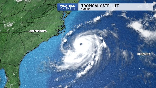
Meanwhile, Hurricane Chris continues to strengthen off the Carolina Coast. However, the storm is now moving away from land and is expected to weaken in the North Atlantic over the weekend. Nonetheless, high surf and dangerous rip currents will continue for the beaches over the next couple of days.