


We had a pronounced wedge, or cold air damming, scenario in place Tuesday across the Carolinas. The result? Much cooler weather with highs in some spots failing to even make 70.
- After cooler weather, warmer temperatures return for the rest of the week.
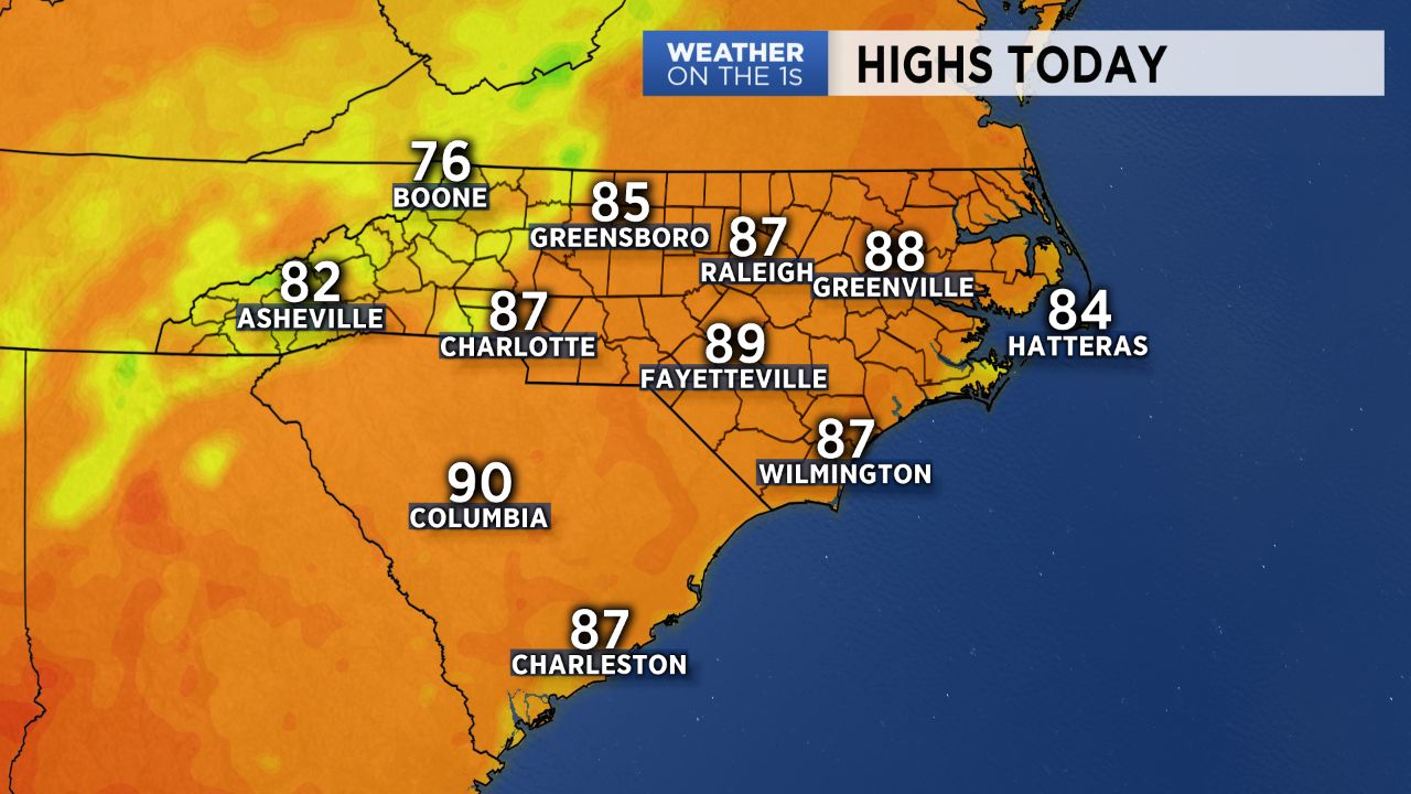
- Highs will warm into the 80s for Wednesday.
- Cold front will drop into the region Thursday.
The wedge is eroding today, and as some intervals of sun build in, highs will warm into the 80s across the region. As warmer air returns, the airmass will be more unstable again, so a few afternoon and evening showers and storms are possible.
A cold front will then drop into the region tomorrow, and the timing of that front will determine tomorrow's rain chances. At this point, I will stay the course and continue to mention the chance of a few Thursday showers and storms.
Behind that front, drier air settles in Friday, and the forecast for Friday and Saturday look nice with lots of sun and highs in the 80s. A few afternoon storms return for Father's Day with highs in the 88-90 degree range.
At this point, much of next work week looks fairly hot with a few daily storms possible.
Get the latest news, sports and weather delivered straight to your inbox. Click here to sign up for email and text alerts.